Cof Cymru: National Historic Assets of Wales · Wales
31 High Street
Offa, Wrexham, Wales
A Grade II listed building in Offa, Wrexham, designated on 31 January 1994.
The record
- Designation
- Listed building, Grade II
- Broad class
- Commercial
- Date of designation
- 31 January 1994
- Community
- Offa
- Unitary authority
- Wrexham
- Country
- Wales
- Coordinates
- 53.04490, -2.99227
- Cadw reference
- 1787
Slide toward Today to fade the historical sheet and see the modern map underneath.
David Rumsey Map Collection, Stanford LibrariesDavid Rumsey Map Collection, Stanford LibrariesDavid Rumsey Map Collection, Stanford LibrariesDavid Rumsey Map Collection, Stanford LibrariesDavid Rumsey Map Collection, Stanford Libraries
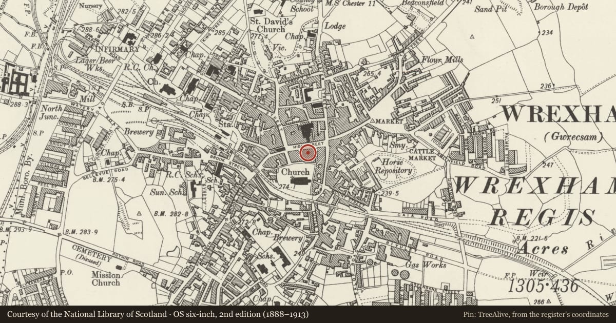
5 historical maps cover this location, the earliest the 1608 map "(13) Cambriae Typus." (David Rumsey Map Collection, Stanford Libraries).
Historical maps covering this location
- 1608 · (13) Cambriae Typus. (David Rumsey Map Collection, Stanford Libraries)
- 1883 · Watershed map England, Wales 3. (David Rumsey Map Collection, Stanford Libraries)
- 1898 · 121 Wrexham (Hills) (David Rumsey Map Collection, Stanford Libraries)
- 1898 · 121 Wrexham (Outline) (David Rumsey Map Collection, Stanford Libraries)
- 1901 · Sheet 9 and 10. (David Rumsey Map Collection, Stanford Libraries)
Cadw's description
Location
Part of a continuously developed building line to the south of High Street.
History
Palmer first noted a building on this site by 1750, but the present building was rebuilt with the Overton Arcade in 1868. It was probably originally intended as a shop with accommodation above, and is now used as offices.
Exterior
Brick with painted stone dressings, used slate roof. 3 storeys, 4 window range, incorporating passage entrance to Overton Arcade to the left. Inserted ground floor frontage, the upper windows are 2-pane sashes in stressed architraves with foliate keystones. Continuous sill band to second storey carried on moulded brackets. Moulded string course over second floor then projecting eaves cornice. Stressed angle quoins. End wall stacks (rebuilt).
Reason for designation
Forms part of an imporatnt group of commercial buildings on High Street.
Nearby in the register
- 33 High StreetCommercialunder 1 mi
- 30 High StreetCommercialunder 1 mi
- Embassey Public HouseCommercialunder 1 mi
- 29 High StreetCommercialunder 1 mi
Other entries of the same register within about three miles of this one, by straight line.