Cof Cymru: National Historic Assets of Wales · Wales
30 High Street
Offa, Wrexham, Wales
A Grade II listed building in Offa, Wrexham, designated on 31 January 1994.
The record
- Designation
- Listed building, Grade II
- Broad class
- Commercial
- Date of designation
- 31 January 1994
- Community
- Offa
- Unitary authority
- Wrexham
- Country
- Wales
- Coordinates
- 53.04497, -2.99213
- Cadw reference
- 1786
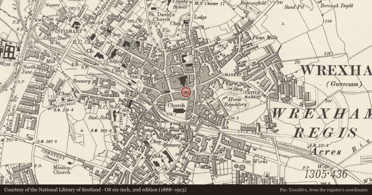
Slide toward Today to fade the historical sheet and see the modern map underneath.
David Rumsey Map Collection, Stanford LibrariesDavid Rumsey Map Collection, Stanford LibrariesDavid Rumsey Map Collection, Stanford LibrariesDavid Rumsey Map Collection, Stanford LibrariesDavid Rumsey Map Collection, Stanford Libraries
5 historical maps cover this location, the earliest the 1608 map "(13) Cambriae Typus." (David Rumsey Map Collection, Stanford Libraries).
Historical maps covering this location
- 1608 · (13) Cambriae Typus. (David Rumsey Map Collection, Stanford Libraries)
- 1883 · Watershed map England, Wales 3. (David Rumsey Map Collection, Stanford Libraries)
- 1898 · 121 Wrexham (Hills) (David Rumsey Map Collection, Stanford Libraries)
- 1898 · 121 Wrexham (Outline) (David Rumsey Map Collection, Stanford Libraries)
- 1901 · Sheet 9 and 10. (David Rumsey Map Collection, Stanford Libraries)
Cadw's description
Location
Part of a continuously developed building line of the S side of the street, and next to the Overton Arcade.
History
According to Palmer, a building was first recorded on the site in 1699 and was in use as an inn by C1710. The present building is largely the result of a mid-C19 rebuilding, but may incorporate elements of an earlier structure.
Exterior
Stucco over brick with painted stone dressings and slate roof with coped gables. 3 storeys, 3-window range. Ground floor frontage entirely rebuilt C1980. Upper windows (renewed to suggest original 12-pane sashes) in moulded architraves, with brackets to sills of upper storey. String course above, with paired brackets to projecting eaves cornice.
Reason for designation
Forms part of an important group of commercial buildings on High Street.
Included for group value.
Nearby in the register
- 29 High StreetCommercialunder 1 mi
- 31 High StreetCommercialunder 1 mi
- 33 High StreetCommercialunder 1 mi
- 26 High StreetCommercialunder 1 mi
Other entries of the same register within about three miles of this one, by straight line.