Cof Cymru: National Historic Assets of Wales · Wales
33 High Street
Offa, Wrexham, Wales
A Grade II listed building in Offa, Wrexham, designated on 16 June 1980.
The record
- Designation
- Listed building, Grade II
- Broad class
- Commercial
- Date of designation
- 16 June 1980
- Community
- Offa
- Unitary authority
- Wrexham
- Country
- Wales
- Coordinates
- 53.04496, -2.99236
- Cadw reference
- 1788
Slide toward Today to fade the historical sheet and see the modern map underneath.
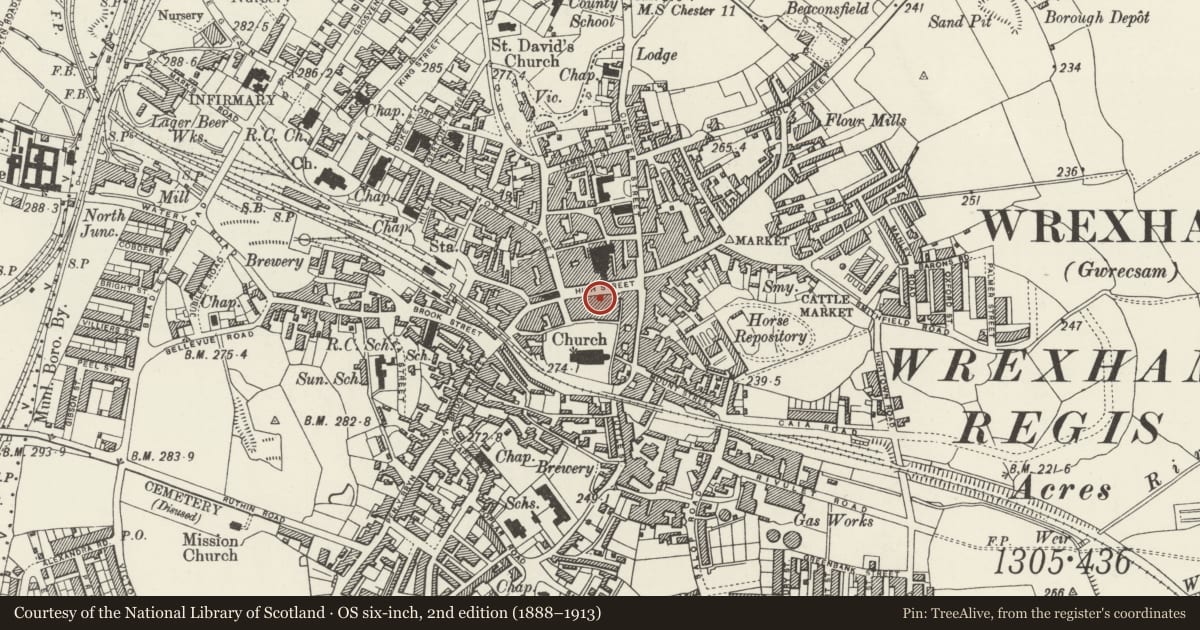
David Rumsey Map Collection, Stanford LibrariesDavid Rumsey Map Collection, Stanford LibrariesDavid Rumsey Map Collection, Stanford LibrariesDavid Rumsey Map Collection, Stanford LibrariesDavid Rumsey Map Collection, Stanford Libraries
5 historical maps cover this location, the earliest the 1608 map "(13) Cambriae Typus." (David Rumsey Map Collection, Stanford Libraries).
Historical maps covering this location
- 1608 · (13) Cambriae Typus. (David Rumsey Map Collection, Stanford Libraries)
- 1883 · Watershed map England, Wales 3. (David Rumsey Map Collection, Stanford Libraries)
- 1898 · 121 Wrexham (Hills) (David Rumsey Map Collection, Stanford Libraries)
- 1898 · 121 Wrexham (Outline) (David Rumsey Map Collection, Stanford Libraries)
- 1901 · Sheet 9 and 10. (David Rumsey Map Collection, Stanford Libraries)
Cadw's description
Location
Part of a continuously developed building line on south side of High Street.
History
Built as a bank in c1912 by Grayson and Ould, architects, for the Bank of Liverpool, and now used as offices.
Exterior
White ashlar to ground floor, red sandstone above, with brick to rear, and slate roof. 3 storeyed with attic, 3 window range. Palazzo style. Paired Corinthian engaged giant columns above ground floor, supporting pediment with modillion cornice and lunette, enriched with garlands. Doorway to right with pediment carried on console brackets, and 2 round arched windows with stressed keystones. Upper windows are sashes, the outer windows of 12-panes, the wider central windows of 20 and 16 panes. Shell motif over central first floor window, and foliate swags beneath upper windows. Egg and dart cornice band below pediment. Coped gables with end wall stacks.
Interior
Retains most of the original plan and some detail including staircase with turned balusters with finials and pendants to newels, and some plaster cornice work, part concealed by suspended ceilings to ground floor. One upper room has a C18 Adam-style fireplace.
Reason for designation
A good example of early C20 commercial architecture, forming part of an important group of commercial buildings.
Nearby in the register
- 31 High StreetCommercialunder 1 mi
- 36 High StreetCommercialunder 1 mi
- Embassey Public HouseCommercialunder 1 mi
- 30 High StreetCommercialunder 1 mi
Other entries of the same register within about three miles of this one, by straight line.