Cof Cymru: National Historic Assets of Wales · Wales
Landore New Quay
Landore, Swansea, Wales
A scheduled monument in Landore, Swansea, recorded as Quay (Post Medieval/Modern).
The record
- Designation
- Scheduled monument
- Site type
- Quay
- Period
- Post Medieval/Modern
- Community
- Landore
- Unitary authority
- Swansea
- Country
- Wales
- Coordinates (centre of the scheduled area)
- 51.64591, -3.93409
- SAM number
- GM484
- Cadw record number
- 900
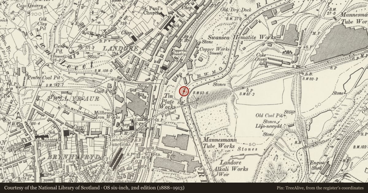
Slide toward Today to fade the historical sheet and see the modern map underneath.
David Rumsey Map Collection, Stanford LibrariesDavid Rumsey Map Collection, Stanford LibrariesUniversity Library, Vrije Universiteit AmsterdamDavid Rumsey Map Collection, Stanford LibrariesUniversity Library, Vrije Universiteit Amsterdam
5 historical maps cover this location, the earliest the 1608 map "(13) Cambriae Typus." (David Rumsey Map Collection, Stanford Libraries).
Historical maps covering this location
- 1608 · (13) Cambriae Typus. (David Rumsey Map Collection, Stanford Libraries)
- 1891 · Sheet 10. Ordnance Survey of England and Wales. . (David Rumsey Map Collection, Stanford Libraries)
- 1897 · 247 Swansea (Hills) (David Rumsey Map Collection, Stanford Libraries)
- Sheet 7 South Wales (University Library, Vrije Universiteit Amsterdam)
- [Kaart] (University Library, Vrije Universiteit Amsterdam)
Cadw's description
Summary description and reason for designation
The following provides a general description of the Scheduled Ancient Monument.
The monument comprises the remains of a stone/wooden quay dating to the post-medieval period. The quay was built between 1772 and 1774 on the River Tawe, which was the principal artery of the coal trade in the lower Swansea valley before the construction of the Swansea Canal. It was built for leading Swansea industrialist, John Morris, by William Edwards a pioneering Welsh engineer. The quay became known as 'New Quay', as it was built at the location of an earlier quay that probably comprised a simple marshy bank. The earlier quay was constructed in the 17th century by Richard Sey and Thomas Price to ship coal down the river. The site became the terminus for Morris's Plas-y-marl timber-railed horse-drawn waggonway between 1769 and 1770. The 'New quay' was considered a great advance, possibly because it was the earliest to have been constructed of stone and in deep-water. The surviving remains of New Quay are of carefully coursed sandstone. At the south end of the quay a probable dock has been filled with rubble, and some timbers survive at the north.
The monument is of national importance for its potential to enhance and illustrate our knowledge and understanding of the early development of local organisation of transportation systems.
The scheduled area comprises the remains described and areas around them within which related evidence may be expected to survive.
Nearby in the register
- Parish Church of St PaulReligious, Ritual and Funeraryunder 1 mi
- Old Siloh Chapel (English) Sunday SchoolReligious, Ritual and Funeraryunder 1 mi
- Old Siloh Chapel (English)Religious, Ritual and Funeraryunder 1 mi
- Dinas Noddfa Baptist ChapelReligious, Ritual and Funeraryunder 1 mi
Other entries of the same register within about three miles of this one, by straight line.