Cof Cymru: National Historic Assets of Wales · Wales
Parish Church of St Paul
Landore, Swansea, Wales
A Grade II listed building in Cwm, Landore, Swansea, designated on 30 March 1987.
The record
- Designation
- Listed building, Grade II
- Broad class
- Religious, Ritual and Funerary
- Date of designation
- 30 March 1987
- Locality
- Cwm
- Community
- Landore
- Unitary authority
- Swansea
- Country
- Wales
- Coordinates
- 51.64653, -3.93656
- Cadw reference
- 11683
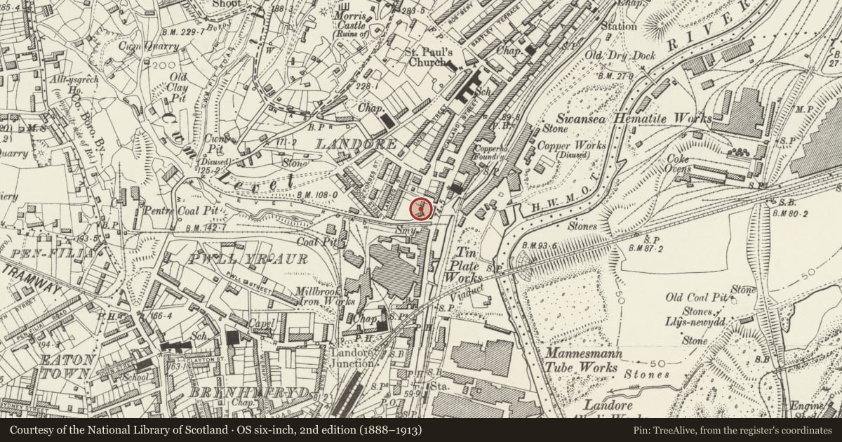
Slide toward Today to fade the historical sheet and see the modern map underneath.
David Rumsey Map Collection, Stanford LibrariesDavid Rumsey Map Collection, Stanford LibrariesDavid Rumsey Map Collection, Stanford LibrariesDavid Rumsey Map Collection, Stanford LibrariesDavid Rumsey Map Collection, Stanford Libraries
5 historical maps cover this location, the earliest the 1636 map "Cornubia : Devonia, Somersetus, Dorcestria, Wiltonia, Glocestria ..." (David Rumsey Map Collection, Stanford Libraries).
Historical maps covering this location
- 1636 · Cornubia : Devonia, Somersetus, Dorcestria, Wiltonia, Glocestria ... (David Rumsey Map Collection, Stanford Libraries)
- 1637 · The fourth table of England. Cornub. Devonia, Somerset etc. (David Rumsey Map Collection, Stanford Libraries)
- 1865 · England and Wales. England No. 6. (David Rumsey Map Collection, Stanford Libraries)
- 1891 · Sheet 10. Ordnance Survey of England and Wales. . (David Rumsey Map Collection, Stanford Libraries)
- 1897 · 247 Swansea (Hills) (David Rumsey Map Collection, Stanford Libraries)
Cadw's description
Location
Set into hillside beside new dual carriageway, tall E end to Neath Road.
History
Ca. 1903 (date on rainwater heads). Perpendicular style with Arts and Crafts influence. Plan of chancel with undercroft, 2-storey SE vestry range with octagonal bell-tower in angle, N chapel, aisled nave with N and S porches.
Exterior
Snecked facings, red sandstone dressings, slate roofs, gable parapets with E crucifix finial, corner buttresses with set-offs. 5-light traceried E window with blind panelling below transom, cill band and weathercourse over 3-part recessed undercroft window with segmental head. Bell-tower has spire with weathervane behind crenellated parapet, linked ogee-headed hood moulds to bell openings, arched doorway in pointed recess. 3-light clerestory windows under segmental arches, tripartite cusped lancets to aisles, image niche over S door with traceried spandrals, double boarded doors up steps. 3-bay W front with 2-light traceried windows and slender buttresses.
Interior
5-bay nave with octagonal piers and pointed arcades (rest of interior not seen).
Nearby in the register
- Landore New QuayQuayunder 1 mi
- Dinas Noddfa Baptist ChapelReligious, Ritual and Funeraryunder 1 mi
- Old Siloh Chapel (English) Sunday SchoolReligious, Ritual and Funeraryunder 1 mi
- Old Siloh Chapel (English)Religious, Ritual and Funeraryunder 1 mi
Other entries of the same register within about three miles of this one, by straight line.