Cof Cymru: National Historic Assets of Wales · Wales
Old Siloh Chapel (English) Sunday School
Landore, Swansea, Wales
A Grade II listed building in Landore, Swansea, designated on 30 March 1987.
The record
- Designation
- Listed building, Grade II
- Broad class
- Religious, Ritual and Funerary
- Date of designation
- 30 March 1987
- Community
- Landore
- Unitary authority
- Swansea
- Country
- Wales
- Coordinates
- 51.64431, -3.93764
- Cadw reference
- 11702
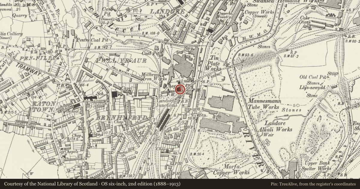
Slide toward Today to fade the historical sheet and see the modern map underneath.
David Rumsey Map Collection, Stanford LibrariesDavid Rumsey Map Collection, Stanford LibrariesDavid Rumsey Map Collection, Stanford LibrariesDavid Rumsey Map Collection, Stanford LibrariesDavid Rumsey Map Collection, Stanford Libraries
5 historical maps cover this location, the earliest the 1636 map "Cornubia : Devonia, Somersetus, Dorcestria, Wiltonia, Glocestria ..." (David Rumsey Map Collection, Stanford Libraries).
Historical maps covering this location
- 1636 · Cornubia : Devonia, Somersetus, Dorcestria, Wiltonia, Glocestria ... (David Rumsey Map Collection, Stanford Libraries)
- 1637 · The fourth table of England. Cornub. Devonia, Somerset etc. (David Rumsey Map Collection, Stanford Libraries)
- 1865 · England and Wales. England No. 6. (David Rumsey Map Collection, Stanford Libraries)
- 1891 · Sheet 10. Ordnance Survey of England and Wales. . (David Rumsey Map Collection, Stanford Libraries)
- 1897 · 247 Swansea (Hills) (David Rumsey Map Collection, Stanford Libraries)
Cadw's description
Location
By roadside immediately W of viaduct on main Swansea-Cardiff railway line.
History
Built 1829, enlarged 1840.
Exterior
Cement rendered classical façade, 4 window bays under pediment. Brick and rubble construction, slate roof, formerly slate-hung sides. "Siloh" tablet with inscribed open book to pediment, banded quoins; architraves to round-headed openings, tall centre pair with keyblocks linked to main cornice. Doorways to outer bays with pedimented doorcases, 6-panel doors, Gothic area railings. Gable end of hall to right, octagonal chimney stacks.
Boarded up at time of inspection (Autumn 1985).
Nearby in the register
- Old Siloh Chapel (English)Religious, Ritual and Funeraryunder 1 mi
- Parish Church of St PaulReligious, Ritual and Funeraryunder 1 mi
- Landore New QuayQuayunder 1 mi
- School House at New Siloh (Congregational) ChapelReligious, Ritual and Funeraryunder 1 mi
Other entries of the same register within about three miles of this one, by straight line.