Cof Cymru: National Historic Assets of Wales · Wales
Garreg Las Hut Group
Cyngor Bro Dyffryn Cennen, Carmarthenshire, Wales
A scheduled monument in Cyngor Bro Dyffryn Cennen, Carmarthenshire, recorded as Enclosed hut circle (Prehistoric).
The record
- Designation
- Scheduled monument
- Site type
- Enclosed hut circle
- Period
- Prehistoric
- Date of designation
- 2 December 1963
- Community
- Cyngor Bro Dyffryn Cennen
- Unitary authority
- Carmarthenshire
- Country
- Wales
- Coordinates (centre of the scheduled area)
- 51.84142, -3.92877
- SAM number
- CM204
- Cadw record number
- 3298
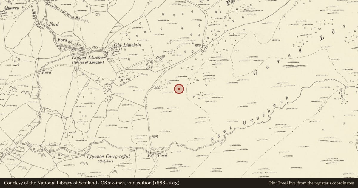
Slide toward Today to fade the historical sheet and see the modern map underneath.
David Rumsey Map Collection, Stanford LibrariesDavid Rumsey Map Collection, Stanford LibrariesDavid Rumsey Map Collection, Stanford LibrariesDavid Rumsey Map Collection, Stanford LibrariesDavid Rumsey Map Collection, Stanford Libraries
5 historical maps cover this location, the earliest the 1860 map "41. Caermathen." (David Rumsey Map Collection, Stanford Libraries).
Historical maps covering this location
- 1860 · 41. Caermathen. (David Rumsey Map Collection, Stanford Libraries)
- 1891 · Sheet 10. Ordnance Survey of England and Wales. . (David Rumsey Map Collection, Stanford Libraries)
- 1898 · 230 Ammanford (Hills) (David Rumsey Map Collection, Stanford Libraries)
- 1898 · 230 Ammanford (Outline) (David Rumsey Map Collection, Stanford Libraries)
- 1901 · Sheet 14. (David Rumsey Map Collection, Stanford Libraries)
Cadw's description
Summary description and reason for designation
The following provides a general description of the Scheduled Ancient Monument.
The monument comprises a hut circle, the foundations of round house, and associated enclosure probably dating to the Bronze Age or Iron Age (c.2300 BC - AD 74). Situated on a north-west facing slope the enclosure measures c 20 m in diameter; the hut circle is set into its east side, partly terraced into the slope to give a level interior and measures c 6m in diameter, it has a west facing entrance gap. Both hut circle and enclosure are defined by partly turfed-over rubble walls averaging 1.5m wide and up to 0.3m high.
The monument is of national importance for its potential to enhance our knowledge of prehistoric domestic life and social organisation. It retains significant archaeological potential, with a strong probability of the presence of structural evidence and associated archaeological features and deposits.
The scheduled area comprises the remains described and areas around them within which related evidence may be expected to survive.
Nearby in the register
- Beddau'r DerwyddonPillow Moundunder 1 mi
- Two Burnt Mounds 350m W of CwrtbrynbeirddBurnt Moundunder 1 mi
- Outbuilding on S side of yard at Cwrt Bryn y BeirddDomesticunder 1 mi
- Outbuilding on E side of yard at Cwrt Bryn y BeirddAgriculture and Subsistenceunder 1 mi
Other entries of the same register within about three miles of this one, by straight line.