Cof Cymru: National Historic Assets of Wales · Wales
Outbuilding on E side of yard at Cwrt Bryn y Beirdd
Dyffryn Cennen, Carmarthenshire, Wales
A Grade II listed building in Trapp, Llandeilo, Dyffryn Cennen, Carmarthenshire, designated on 24 November 1998.
The record
- Designation
- Listed building, Grade II
- Broad class
- Agriculture and Subsistence
- Date of designation
- 24 November 1998
- Locality
- Trapp
- Town
- Llandeilo
- Community
- Dyffryn Cennen
- Unitary authority
- Carmarthenshire
- Country
- Wales
- Coordinates
- 51.84541, -3.94175
- Cadw reference
- 20920
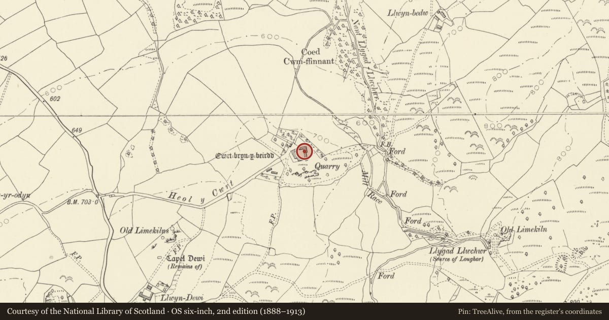
Slide toward Today to fade the historical sheet and see the modern map underneath.
David Rumsey Map Collection, Stanford LibrariesDavid Rumsey Map Collection, Stanford LibrariesDavid Rumsey Map Collection, Stanford LibrariesDavid Rumsey Map Collection, Stanford LibrariesDavid Rumsey Map Collection, Stanford Libraries
5 historical maps cover this location, the earliest the 1860 map "41. Caermathen." (David Rumsey Map Collection, Stanford Libraries).
Historical maps covering this location
- 1860 · 41. Caermathen. (David Rumsey Map Collection, Stanford Libraries)
- 1891 · Sheet 10. Ordnance Survey of England and Wales. . (David Rumsey Map Collection, Stanford Libraries)
- 1898 · 230 Ammanford (Hills) (David Rumsey Map Collection, Stanford Libraries)
- 1898 · 230 Ammanford (Outline) (David Rumsey Map Collection, Stanford Libraries)
- 1901 · Sheet 14. (David Rumsey Map Collection, Stanford Libraries)
Cadw's description
Location
Situated at right end of E side of courtyard at Cwrt Bryn-y-Beirdd.
History
Part of the extensive courtyard group at Bryn y Beirdd, this part added to the medieval S range before 1858, as marked on plan in Archaeologia Cambrensis. Probably early C19.
Exterior
Part of four-sided courtyard with farmhouse, S range and NE range separately listed. Rubble stone with corrugated iron roof, slightly lower than adjoining S range. Five doors, the first low and in angle, next with stone voussoirs, both blocked, then centre large door with stone slab lintel and loading door immediately above, up to eaves. Two doors further left, with stone voussoirs. Loft has loop at right and small blocked window at left. Straight joint to added barn to left (listed with NE range)
Reason for designation
Included as part of the courtyard farm group at Cwrt Bryn y Beirdd.
Nearby in the register
- Farm buildings on NE angle of yard at Cwrt Bryn y BeirddAgriculture and Subsistenceunder 1 mi
- Outbuilding on S side of yard at Cwrt Bryn y BeirddDomesticunder 1 mi
- Cwrt Bryn y BeirddDomesticunder 1 mi
- Two Burnt Mounds 350m W of CwrtbrynbeirddBurnt Moundunder 1 mi
Other entries of the same register within about three miles of this one, by straight line.