Cof Cymru: National Historic Assets of Wales · Wales
Gates, piers and walls at entrance to Glanwysg
Maescar, Powys, Wales
A Grade II listed building in Sennybridge, Brecon, Maescar, Powys, designated on 28 October 2005.
The record
- Designation
- Listed building, Grade II
- Broad class
- Domestic
- Date of designation
- 28 October 2005
- Locality
- Sennybridge
- Town
- Brecon
- Community
- Maescar
- Unitary authority
- Powys
- Country
- Wales
- Coordinates
- 51.94382, -3.57810
- Cadw reference
- 86911
Slide toward Today to fade the historical sheet and see the modern map underneath.
David Rumsey Map Collection, Stanford LibrariesDavid Rumsey Map Collection, Stanford LibrariesDavid Rumsey Map Collection, Stanford LibrariesDavid Rumsey Map Collection, Stanford LibrariesDavid Rumsey Map Collection, Stanford Libraries
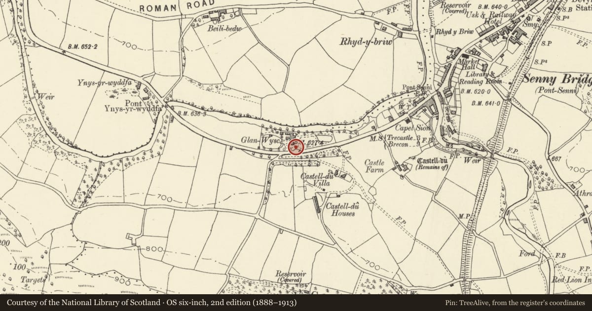
5 historical maps cover this location, the earliest the 1636 map "Cornubia : Devonia, Somersetus, Dorcestria, Wiltonia, Glocestria ..." (David Rumsey Map Collection, Stanford Libraries).
Historical maps covering this location
- 1636 · Cornubia : Devonia, Somersetus, Dorcestria, Wiltonia, Glocestria ... (David Rumsey Map Collection, Stanford Libraries)
- 1830 · V.3:11-15:XV. Britisches Reich. A. Kon: England. b. Frstenthum Wales: Shire: 37-40 (David Rumsey Map Collection, Stanford Libraries)
- 1856 · 42. Brecon. (David Rumsey Map Collection, Stanford Libraries)
- 1898 · 213 Brecon (Hills) (David Rumsey Map Collection, Stanford Libraries)
- 1901 · Sheet 14. (David Rumsey Map Collection, Stanford Libraries)
Cadw's description
Location
Situated on S side of A40 just W of Sennybridge.
History
Entrance gates to Glanwysg or Glanusk a small country house built in 1822 for John Christie owner of the Brecon Forest Tramway.
Exterior
Two gatepiers of tooled stone with square stepped caps and low plinths, double iron gates ramped down to meeting stile, with double mid-rail and spearhead bars. Two curving walls out to outer piers of squared tooled stone. A length of rubble wall runs back from the W pier to link to a tooled stone pentagonal pier with flat cap.
Reason for designation
Included for its special interest as the entrance to a late Georgian country house, of group value with Glanwysg.
Nearby in the register
- GlanwysgDomesticunder 1 mi
- Castle Du CottageDomesticunder 1 mi
- Milestone outside Milestone CottageTransportunder 1 mi
- Sion Baptist ChapelReligious, Ritual and Funeraryunder 1 mi
Other entries of the same register within about three miles of this one, by straight line.