Cof Cymru: National Historic Assets of Wales · Wales
Castle Du Cottage
Maescar, Powys, Wales
A Grade II listed building in Sennybridge, Brecon, Maescar, Powys, designated on 28 October 2005.
The record
- Designation
- Listed building, Grade II
- Broad class
- Domestic
- Date of designation
- 28 October 2005
- Locality
- Sennybridge
- Town
- Brecon
- Community
- Maescar
- Unitary authority
- Powys
- Country
- Wales
- Coordinates
- 51.94246, -3.57724
- Cadw reference
- 86904
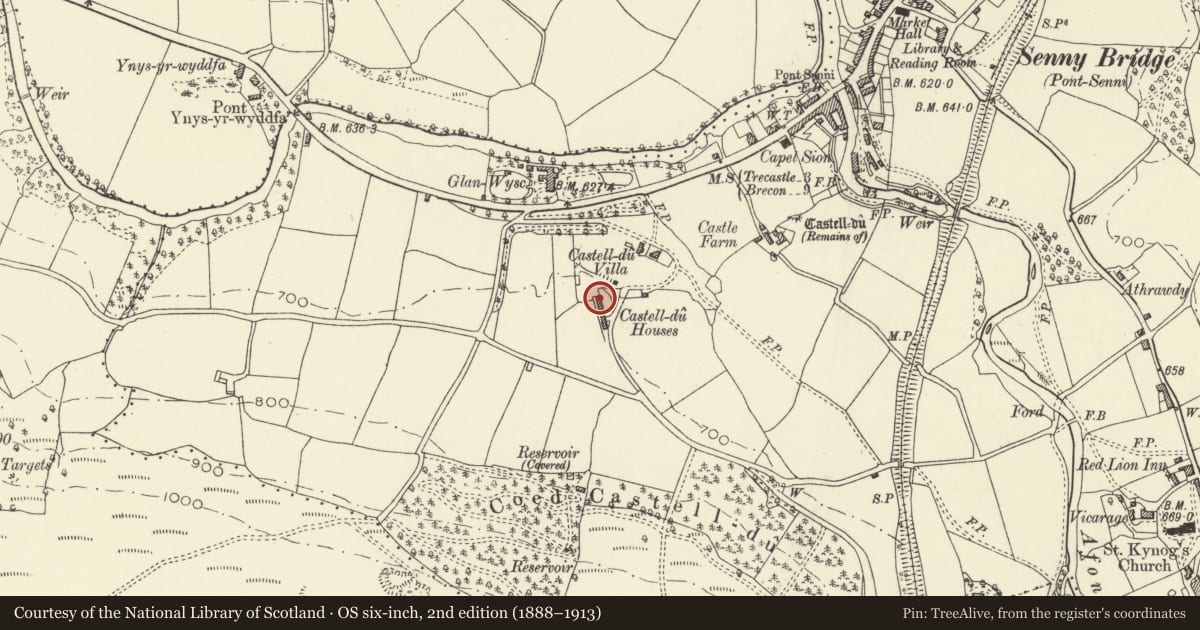
Slide toward Today to fade the historical sheet and see the modern map underneath.
David Rumsey Map Collection, Stanford LibrariesDavid Rumsey Map Collection, Stanford LibrariesDavid Rumsey Map Collection, Stanford LibrariesDavid Rumsey Map Collection, Stanford LibrariesDavid Rumsey Map Collection, Stanford Libraries
5 historical maps cover this location, the earliest the 1636 map "Cornubia : Devonia, Somersetus, Dorcestria, Wiltonia, Glocestria ..." (David Rumsey Map Collection, Stanford Libraries).
Historical maps covering this location
- 1636 · Cornubia : Devonia, Somersetus, Dorcestria, Wiltonia, Glocestria ... (David Rumsey Map Collection, Stanford Libraries)
- 1830 · V.3:11-15:XV. Britisches Reich. A. Kon: England. b. Frstenthum Wales: Shire: 37-40 (David Rumsey Map Collection, Stanford Libraries)
- 1856 · 42. Brecon. (David Rumsey Map Collection, Stanford Libraries)
- 1898 · 213 Brecon (Hills) (David Rumsey Map Collection, Stanford Libraries)
- 1901 · Sheet 14. (David Rumsey Map Collection, Stanford Libraries)
Cadw's description
Location
Situated by Castell Du farmhouse on slope to S of W end of Sennybridge, reached by drive off lane from Trephilip Bridge.
History
Cottages now house probably built in the 1820s at the same time as the adjacent Castle Du which was the northern depot of the Brecon Forest tramroad, the drive marking the tram route which continued on down to the A40 opposite Glan Wysg, home of John Christie promoter of the tramway in the 1820s. Occupied by the Lewis family from early C20.
Exterior
Former cottages, now house, white painted rubble stone with imitation slate roof and four roughcast brick stacks. Long range, two storeys: at right end a double-fronted house with two 9-pane Brecon hopper windows each floor and centre door. Cambered brick heads, stone sills. This has chimneys each end and straight joint to a two-bay section with centre chimney, similar 9-pane sashes above and 12-pane below, with tooled stone sills, but no door. the final section, to left, is set back, two-bay with left end chimney, 12-pane sash each floor to left with brick heads, 9-pane to right with stone voussoirs, over door with timber lintel and stone shelf. Stone sills. Single storey addition on right end.
Interior
Interior not inspected.
Reason for designation
Included for its special historic interest as an early C19 cottage row associated with the Brecon Forest Tramroad.
Nearby in the register
- Gates, piers and walls at entrance to GlanwysgDomesticunder 1 mi
- GlanwysgDomesticunder 1 mi
- Milestone outside Milestone CottageTransportunder 1 mi
- Castell-Du, SennybridgeCastleunder 1 mi
Other entries of the same register within about three miles of this one, by straight line.