Cof Cymru: National Historic Assets of Wales · Wales
Former cart shed and workshop at Argoed Mill
Nantmel, Powys, Wales
A Grade II listed building in Doldowlod, Nantmel, Powys, designated on 28 February 2005.
The record
- Designation
- Listed building, Grade II
- Broad class
- No class recorded
- Date of designation
- 28 February 2005
- Locality
- Doldowlod
- Community
- Nantmel
- Unitary authority
- Powys
- Country
- Wales
- Coordinates
- 52.25469, -3.47344
- Cadw reference
- 84121
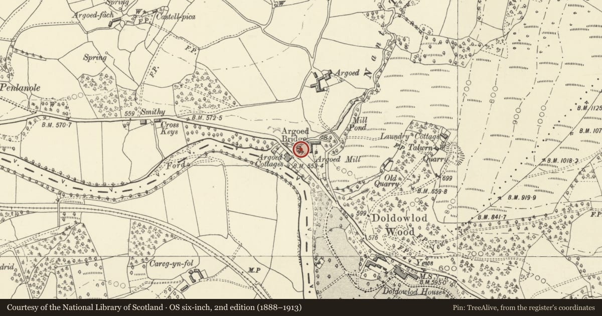
Slide toward Today to fade the historical sheet and see the modern map underneath.
David Rumsey Map Collection, Stanford LibrariesDavid Rumsey Map Collection, Stanford LibrariesDavid Rumsey Map Collection, Stanford LibrariesDavid Rumsey Map Collection, Stanford LibrariesDavid Rumsey Map Collection, Stanford Libraries
5 historical maps cover this location, the earliest the 1608 map "(13) Cambriae Typus." (David Rumsey Map Collection, Stanford Libraries).
Historical maps covering this location
- 1608 · (13) Cambriae Typus. (David Rumsey Map Collection, Stanford Libraries)
- 1637 · Particular description of Wales. Cambria seu Wallia (David Rumsey Map Collection, Stanford Libraries)
- 1883 · Watershed map England, Wales 3. (David Rumsey Map Collection, Stanford Libraries)
- 1898 · 179 Rhyader (Hills) (David Rumsey Map Collection, Stanford Libraries)
- 1901 · Sheet 14. (David Rumsey Map Collection, Stanford Libraries)
Cadw's description
Location
On the W side of the mill, set back from the road.
History
Probably contemporary with the rebuilding of Argoed Mill in 1878 and shown on the 1889 Ordnance Survey.
Exterior
A single-storey shed of rubble-stone end and rear walls and slate roof. The front has full-height double boarded doors to the L, a single boarded door immediately to its R, to the R of which the front is clad in corrugated iron with 2-light window.
Reason for designation
Listed for group value with the former Argoed Mill and associated buildings, and for its contribution to the overall historic character of Argoed hamlet.
Nearby in the register
- Corn-drying shed at Argoed MillNo class recordedunder 1 mi
- Telephone Call-box at entrance to Argoed MillNo class recordedunder 1 mi
- Argoed Mill CottageNo class recordedunder 1 mi
- Argoed Mill Old Post OfficeNo class recordedunder 1 mi
Other entries of the same register within about three miles of this one, by straight line.