Cof Cymru: National Historic Assets of Wales · Wales
Beehive Pigsty at Peacock Farm
Halkyn, Flintshire, Wales
A Grade II listed building in Rhes-y-cae, Holywell, Halkyn, Flintshire, designated on 13 January 1987.
The record
- Designation
- Listed building, Grade II
- Broad class
- Agriculture and Subsistence
- Date of designation
- 13 January 1987
- Locality
- Rhes-y-cae
- Town
- Holywell
- Community
- Halkyn
- Unitary authority
- Flintshire
- Country
- Wales
- Coordinates
- 53.23010, -3.21894
- Cadw reference
- 553
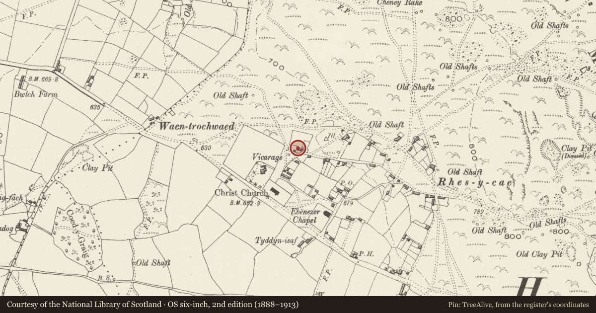
Slide toward Today to fade the historical sheet and see the modern map underneath.
David Rumsey Map Collection, Stanford LibrariesDavid Rumsey Map Collection, Stanford LibrariesDavid Rumsey Map Collection, Stanford LibrariesDavid Rumsey Map Collection, Stanford LibrariesLlyfrgell Genedlaethol Cymru – The National Library of Wales
5 historical maps cover this location, the earliest the 1795 map "To Sir Watkin Williams-Wynn Bart ... the map of the six counties of North Wales is most humbly inscribed by his obedient humble servant" (Llyfrgell Genedlaethol Cymru – The National Library of Wales).
Historical maps covering this location
- 1795 · To Sir Watkin Williams-Wynn Bart ... the map of the six counties of North Wales is most… (Llyfrgell Genedlaethol Cymru – The National Library of Wales)
- 1883 · Watershed map England, Wales 3. (David Rumsey Map Collection, Stanford Libraries)
- 1898 · 108 Flint (Hills) (David Rumsey Map Collection, Stanford Libraries)
- 1898 · 108 Flint (Outline) (David Rumsey Map Collection, Stanford Libraries)
- 1901 · Sheet 9 and 10. (David Rumsey Map Collection, Stanford Libraries)
Cadw's description
Location
On the W side of the house, which is reached by a track and is 150m NNE of the parish church.
Exterior
A late C18 or early C19 oval animal shelter construction to ancient corbelled technique, comprising rubble stone walls and vault. The top is partly missing. A low entrance on the S side has a stone lintel (a former timber shutter is missing). Small opening at rear. Well-preserved interior with lower earth floor.
Reason for designation
Listed as a rare surviving example in N Wales of a once common agricultural building type.
Nearby in the register
- Christ ChurchReligious, Ritual and Funeraryunder 1 mi
- Bryn IdrisDomesticunder 1 mi
- Waen FarmDomesticunder 1 mi
- The Stores HouseCommercialunder 1 mi
Other entries of the same register within about three miles of this one, by straight line.