Cof Cymru: National Historic Assets of Wales · Wales
Waen Farm
Ysceifiog, Flintshire, Wales
A Grade II listed building in Rhes-y-cae, Holywell, Ysceifiog, Flintshire, designated on 31 January 2001.
The record
- Designation
- Listed building, Grade II
- Broad class
- Domestic
- Date of designation
- 31 January 2001
- Locality
- Rhes-y-cae
- Town
- Holywell
- Community
- Ysceifiog
- Unitary authority
- Flintshire
- Country
- Wales
- Coordinates
- 53.23086, -3.22516
- Cadw reference
- 24685
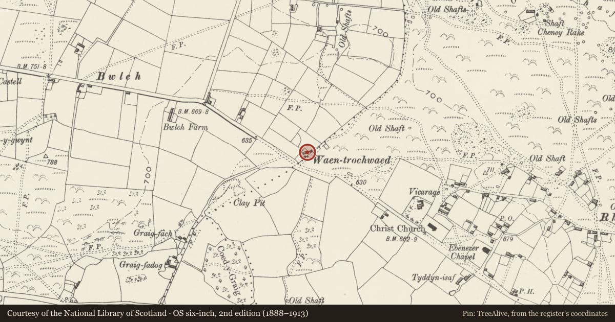
Slide toward Today to fade the historical sheet and see the modern map underneath.
David Rumsey Map Collection, Stanford LibrariesDavid Rumsey Map Collection, Stanford LibrariesDavid Rumsey Map Collection, Stanford LibrariesDavid Rumsey Map Collection, Stanford LibrariesLlyfrgell Genedlaethol Cymru – The National Library of Wales
5 historical maps cover this location, the earliest the 1795 map "To Sir Watkin Williams-Wynn Bart ... the map of the six counties of North Wales is most humbly inscribed by his obedient humble servant" (Llyfrgell Genedlaethol Cymru – The National Library of Wales).
Historical maps covering this location
- 1795 · To Sir Watkin Williams-Wynn Bart ... the map of the six counties of North Wales is most… (Llyfrgell Genedlaethol Cymru – The National Library of Wales)
- 1883 · Watershed map England, Wales 3. (David Rumsey Map Collection, Stanford Libraries)
- 1898 · 108 Flint (Hills) (David Rumsey Map Collection, Stanford Libraries)
- 1898 · 108 Flint (Outline) (David Rumsey Map Collection, Stanford Libraries)
- 1901 · Sheet 9 and 10. (David Rumsey Map Collection, Stanford Libraries)
Cadw's description
Location
Approximately 1.3km E of Lixwm village and set back on the N side of a minor road between Lixwm and Rhes-y-cae.
History
Probably built in the 1840s and shown on the 1849 Tithe map.
Exterior
A single-storey 3-window house of pebble-dashed walls and slate roof, partly renewed, and rendered stacks to the ends and L of centre. A gabled porch R of centre has a boarded door on its L side and a window renewed to the front. The house has 2-light casement windows with stone sills. Set back against the R gable end is a stable with corrugated iron roof. It has a boarded door to the L, R of which are small wood-mullioned vents beneath the eaves. The rear of the house has a single window on the R side and outshuts.
Interior
Not inspected.
Reason for designation
Listed as a well-preserved distinctive single-storeyed regional house type of the C19, retaining vernacular character.
Nearby in the register
- Christ ChurchReligious, Ritual and Funeraryunder 1 mi
- Beehive Pigsty at Peacock FarmAgriculture and Subsistenceunder 1 mi
- Round Barrow 180m E of MwccwdRound Barrowunder 1 mi
- Bryn IdrisDomesticunder 1 mi
Other entries of the same register within about three miles of this one, by straight line.