Cof Cymru: National Historic Assets of Wales · Wales
Rhanberfydd Farmhouse and Cottage
Hope, Flintshire, Wales
A Grade II listed building in Rhanberfydd Farm, Hope, Flintshire, designated on 8 April 1975.
The record
- Designation
- Listed building, Grade II
- Broad class
- Domestic
- Date of designation
- 8 April 1975
- Locality
- Rhanberfydd Farm
- Community
- Hope
- Unitary authority
- Flintshire
- Country
- Wales
- Coordinates
- 53.11740, -3.04804
- Cadw reference
- 48
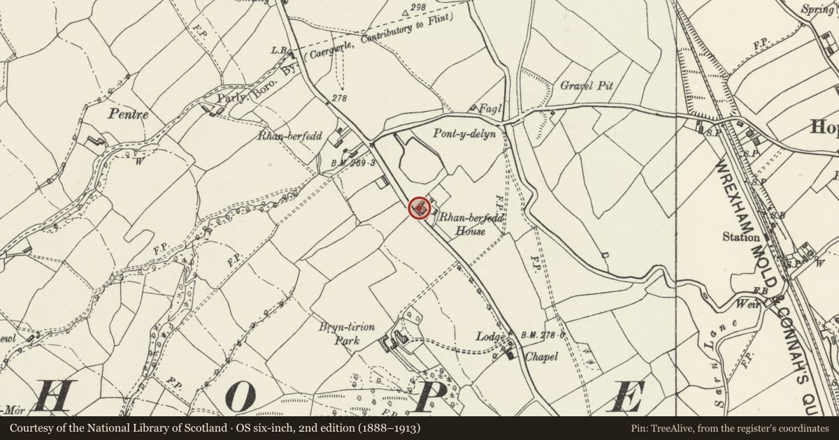
Slide toward Today to fade the historical sheet and see the modern map underneath.
David Rumsey Map Collection, Stanford LibrariesDavid Rumsey Map Collection, Stanford LibrariesDavid Rumsey Map Collection, Stanford LibrariesDavid Rumsey Map Collection, Stanford LibrariesLlyfrgell Genedlaethol Cymru – The National Library of Wales
5 historical maps cover this location, the earliest the 1795 map "To Sir Watkin Williams-Wynn Bart ... the map of the six counties of North Wales is most humbly inscribed by his obedient humble servant" (Llyfrgell Genedlaethol Cymru – The National Library of Wales).
Historical maps covering this location
- 1795 · To Sir Watkin Williams-Wynn Bart ... the map of the six counties of North Wales is most… (Llyfrgell Genedlaethol Cymru – The National Library of Wales)
- 1883 · Watershed map England, Wales 3. (David Rumsey Map Collection, Stanford Libraries)
- 1898 · 108 Flint (Hills) (David Rumsey Map Collection, Stanford Libraries)
- 1898 · 108 Flint (Outline) (David Rumsey Map Collection, Stanford Libraries)
- 1901 · Sheet 9 and 10. (David Rumsey Map Collection, Stanford Libraries)
Cadw's description
Location
Located on the NE side of the main Mold to Wrexham road, approximately 1km E of Hope village.
Exterior
Two-storey house of mid C19 date with lower two-storey wing adjoining it in western elevation. Stone walls. House with pyramidical slate roof; west and garden elevations of two bays each; sash windows without glazing bars and with horns; painted lintels; louvred shutters; doorway in west elevation with six-panelled door and plain rectangular light over. Lower two-storey cottage wing thought to be older but no details of interior supplied; west elevation of two bays and centre door bay. Slate gabled roof with end coping and kneeler. Sash windows without glazing bars and with horns; louvred shutters; said to be a blocked window over doorway. Part of front garden before house and cottage enclosed by a wall of stone.
LIST DESCRIPTION NOT AMENDED AT TIME OF COMMUNITY RESURVEY IN MAY 1998.
Nearby in the register
- Pont-y-DelynTransportunder 1 mi
- Sarn HouseDomesticunder 1 mi
- Pack Horse BridgeTransportunder 1 mi
- Lilac CottageDomesticunder 1 mi
Other entries of the same register within about three miles of this one, by straight line.