Cof Cymru: National Historic Assets of Wales · Wales
Pont-y-Delyn
Hope, Flintshire, Wales
A Grade II listed building in Hope, Flintshire, designated on 2 July 1962.
The record
- Designation
- Listed building, Grade II
- Broad class
- Transport
- Date of designation
- 2 July 1962
- Locality
- Hope
- Community
- Hope
- Unitary authority
- Flintshire
- Country
- Wales
- Coordinates
- 53.11899, -3.04534
- Cadw reference
- 33
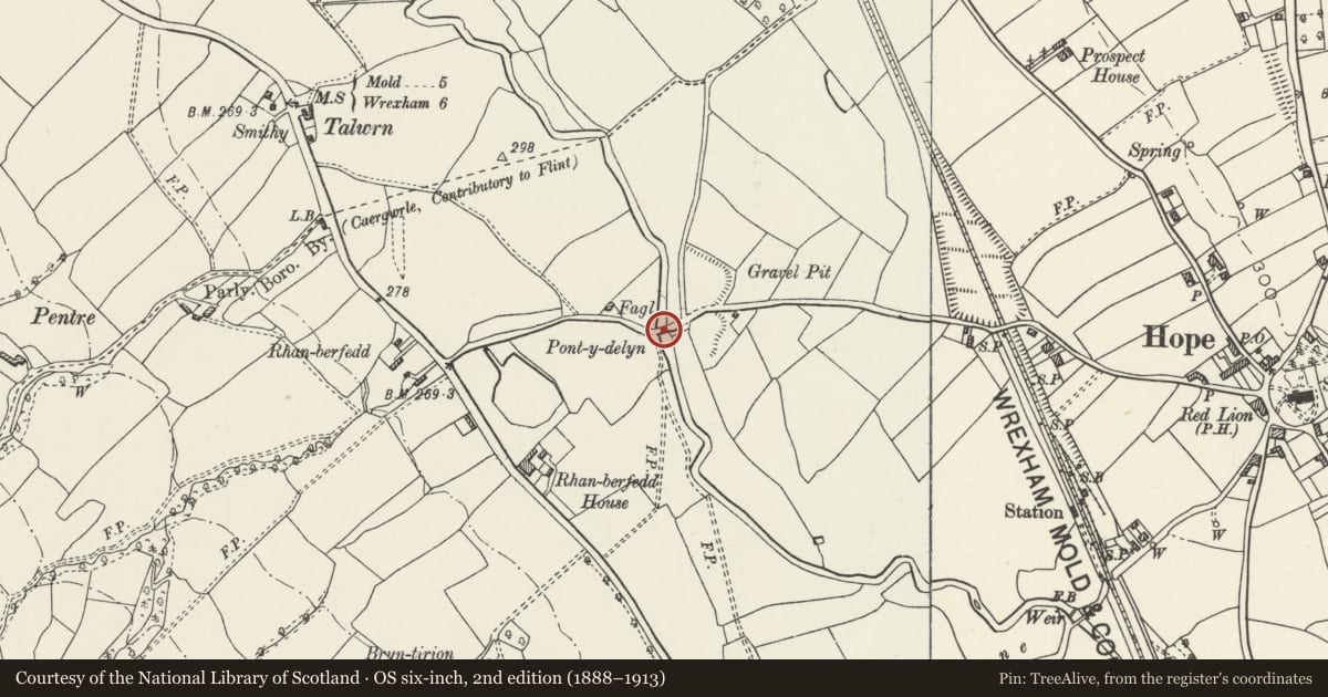
Slide toward Today to fade the historical sheet and see the modern map underneath.
David Rumsey Map Collection, Stanford LibrariesDavid Rumsey Map Collection, Stanford LibrariesDavid Rumsey Map Collection, Stanford LibrariesDavid Rumsey Map Collection, Stanford LibrariesLlyfrgell Genedlaethol Cymru – The National Library of Wales
5 historical maps cover this location, the earliest the 1795 map "To Sir Watkin Williams-Wynn Bart ... the map of the six counties of North Wales is most humbly inscribed by his obedient humble servant" (Llyfrgell Genedlaethol Cymru – The National Library of Wales).
Historical maps covering this location
- 1795 · To Sir Watkin Williams-Wynn Bart ... the map of the six counties of North Wales is most… (Llyfrgell Genedlaethol Cymru – The National Library of Wales)
- 1883 · Watershed map England, Wales 3. (David Rumsey Map Collection, Stanford Libraries)
- 1898 · 108 Flint (Hills) (David Rumsey Map Collection, Stanford Libraries)
- 1898 · 108 Flint (Outline) (David Rumsey Map Collection, Stanford Libraries)
- 1901 · Sheet 9 and 10. (David Rumsey Map Collection, Stanford Libraries)
Cadw's description
Location
Spanning the Afon Alun immediately S of the road and carrying the old Fagl Lane; approximately 1km W of the village centre.
History
A bridge at this point was referred to by Edward Lhwyd in 1699 as the 'Pont-y-Dorlyn'. The present bridge is probably a late C18 replacement.
Exterior
Single-span road bridge approximately 20m long; of sandstone ashlar construction. Depressed arch with voussoirs conjoined with horizontal courses plain stringcourses below parapets with long, curved capping stones. Flat carriageway with four pairs of curved kerbstones; curved approaches with square terminating piers. The upstream approach to the W continues as a rubble revetment with two further buttresses. The bridge is currently unused.
Reason for designation
Listed for its special historic interest as a late C18 road bridge.
Nearby in the register
- Rhanberfydd Farmhouse and CottageDomesticunder 1 mi
- Sarn HouseDomesticunder 1 mi
- Steps, Gates and Gatepiers to W of St Cyngar's ChurchGardens, Parks and Urban Spacesunder 1 mi
- Railed Tomb Monument 30m NW of St Cyngar's ChurchReligious, Ritual and Funeraryunder 1 mi
Other entries of the same register within about three miles of this one, by straight line.