Cof Cymru: National Historic Assets of Wales · Wales
The Greyhound Inn
Usk, Monmouthshire, Wales
A Grade II listed building in Usk, Monmouthshire, designated on 1 April 1974.
The record
- Designation
- Listed building, Grade II
- Broad class
- Commercial
- Date of designation
- 1 April 1974
- Locality
- Usk
- Town
- Usk
- Community
- Usk
- Unitary authority
- Monmouthshire
- Country
- Wales
- Coordinates
- 51.70366, -2.89749
- Cadw reference
- 2140
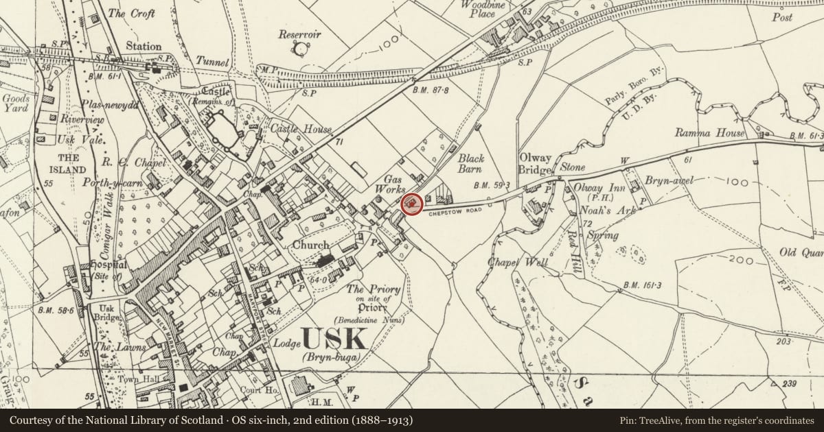
Slide toward Today to fade the historical sheet and see the modern map underneath.
David Rumsey Map Collection, Stanford LibrariesDavid Rumsey Map Collection, Stanford LibrariesDavid Rumsey Map Collection, Stanford LibrariesDavid Rumsey Map Collection, Stanford LibrariesDavid Rumsey Map Collection, Stanford Libraries
5 historical maps cover this location, the earliest the 1636 map "Cornubia : Devonia, Somersetus, Dorcestria, Wiltonia, Glocestria ..." (David Rumsey Map Collection, Stanford Libraries).
Historical maps covering this location
- 1636 · Cornubia : Devonia, Somersetus, Dorcestria, Wiltonia, Glocestria ... (David Rumsey Map Collection, Stanford Libraries)
- 1637 · The fourth table of England. Cornub. Devonia, Somerset etc. (David Rumsey Map Collection, Stanford Libraries)
- 1830 · V.3:11-15:XV.Britisches Reich. A. Kon: England. a. England ab sich: Shire:15-17, 33 (David Rumsey Map Collection, Stanford Libraries)
- 1895 · Sheet 11. Ordnance Survey of England and Wales. (David Rumsey Map Collection, Stanford Libraries)
- 1913 · Sheet 102. Newport. (David Rumsey Map Collection, Stanford Libraries)
Cadw's description
Location
Near the E edge of the town, and a short way E of the priory churchyard, on a corner site; Chepstow Road is the continuation of Four Ash Street.
History
Early origin suggested by deep battered gable end to right. Refurbished early - mid C19. An inn on the E town boundary serving travellers between Usk and Chepstow
Exterior
Small inn. Built of stone rubble rendered with roughcast; slate roof with overhanging boarded eaves and tall roughcast corniced end stacks. Single storey and attic. Symmetrical frontage: a full-height central gabled projecting bay with full dormer; ground floor windows either side of pointed-arched doorway with recessed door. C20 casement windows. Rear elevation shows a lower cross wing incorporated into a parallel higher and later cross wing. Two small first floor casements with shallow segmental arched heads to side.
Interior
Interior now a single room, former divisions removed. C19 fireplace to right, dado rail and boarding.
Reason for designation
An inn of early origins which has retained its character.
Nearby in the register
- Dairy BarnAgriculture and Subsistenceunder 1 mi
- Nos.35 and 37 (part) Four Ash StreetDomesticunder 1 mi
- 2 Four Ash Street, and attached iron railingsDomesticunder 1 mi
- 31 Four Ash StreetDomesticunder 1 mi
Other entries of the same register within about three miles of this one, by straight line.