Cof Cymru: National Historic Assets of Wales · Wales
2 Four Ash Street, and attached iron railings
Usk, Monmouthshire, Wales
A Grade II listed building in Usk, Monmouthshire, designated on 1 April 1974.
The record
- Designation
- Listed building, Grade II
- Broad class
- Domestic
- Date of designation
- 1 April 1974
- Locality
- Usk
- Town
- Usk
- Community
- Usk
- Unitary authority
- Monmouthshire
- Country
- Wales
- Coordinates
- 51.70307, -2.89905
- Cadw reference
- 2146
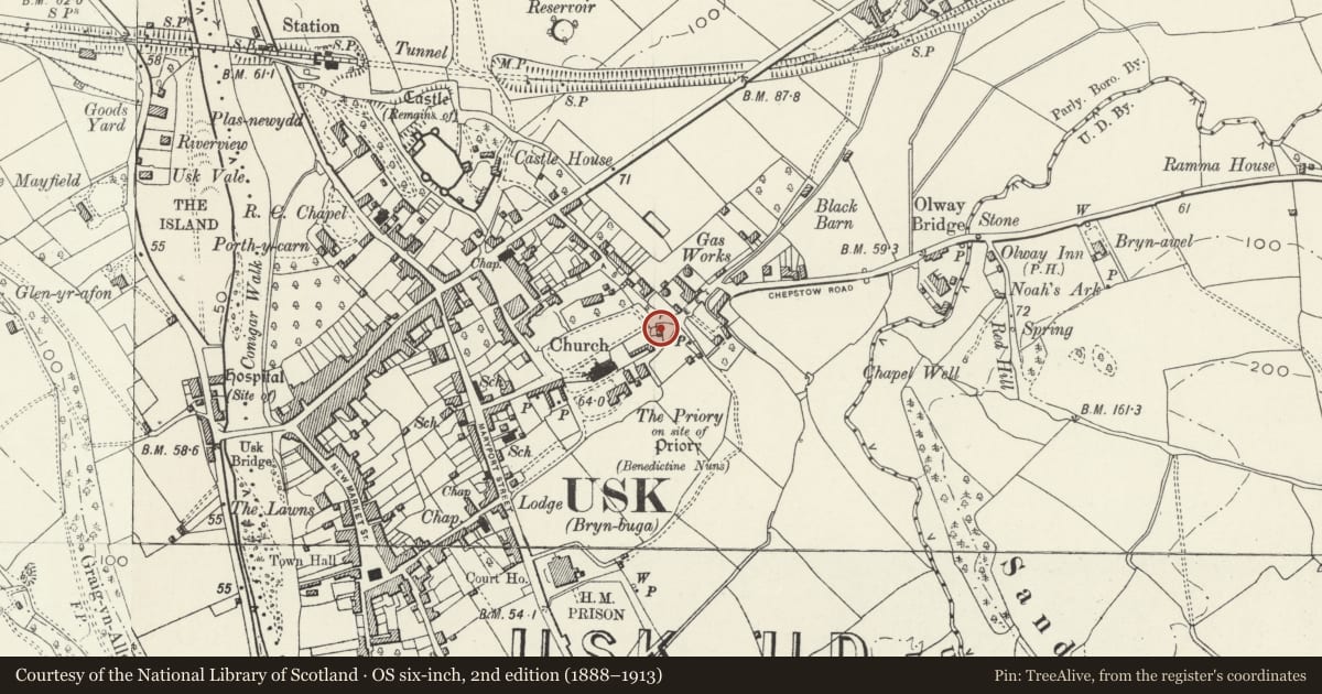
Slide toward Today to fade the historical sheet and see the modern map underneath.
David Rumsey Map Collection, Stanford LibrariesDavid Rumsey Map Collection, Stanford LibrariesDavid Rumsey Map Collection, Stanford LibrariesDavid Rumsey Map Collection, Stanford LibrariesDavid Rumsey Map Collection, Stanford Libraries
5 historical maps cover this location, the earliest the 1636 map "Cornubia : Devonia, Somersetus, Dorcestria, Wiltonia, Glocestria ..." (David Rumsey Map Collection, Stanford Libraries).
Historical maps covering this location
- 1636 · Cornubia : Devonia, Somersetus, Dorcestria, Wiltonia, Glocestria ... (David Rumsey Map Collection, Stanford Libraries)
- 1637 · The fourth table of England. Cornub. Devonia, Somerset etc. (David Rumsey Map Collection, Stanford Libraries)
- 1830 · V.3:11-15:XV.Britisches Reich. A. Kon: England. a. England ab sich: Shire:15-17, 33 (David Rumsey Map Collection, Stanford Libraries)
- 1895 · Sheet 11. Ordnance Survey of England and Wales. (David Rumsey Map Collection, Stanford Libraries)
- 1913 · Sheet 102. Newport. (David Rumsey Map Collection, Stanford Libraries)
Cadw's description
Location
Adjacent to the E entrance to the churchyard, on a corner site facing up the street.
History
Early C19. Originally owned by the church and used as parish office.
Exterior
Detached cottage. Roughcast-rendered and painted; slate roof, with Gothick eaves cornice; narrow and long end stacks set across the ridge. Two storeys. Two-window range of sashes in reveals, 12/8 panes with Gothick intersecting glazing bars in the top sash. Ground floor doorway to right with bracketed gabled hood, fluted doorcase with recessed 6-panel door and transom light with polygonal glazing. Adjoining stone wall joins with front kerb which has iron railings with leaf and anthemion finials.
Reason for designation
Listed as an early C19 house retaining character including Gothick glazing. Group value with other listed buildings in Four Ash Street, St Mary's church and churchyard wall and gates.
Nearby in the register
- Nos.35 and 37 (part) Four Ash StreetDomesticunder 1 mi
- Dairy BarnAgriculture and Subsistenceunder 1 mi
- 31 Four Ash StreetDomesticunder 1 mi
- Priory Church of St MaryReligious, Ritual and Funeraryunder 1 mi
Other entries of the same register within about three miles of this one, by straight line.