Cof Cymru: National Historic Assets of Wales · Wales
31 Four Ash Street
Usk, Monmouthshire, Wales
A Grade II listed building in Usk, Monmouthshire, designated on 3 July 1973.
The record
- Designation
- Listed building, Grade II
- Broad class
- Domestic
- Date of designation
- 3 July 1973
- Locality
- Usk
- Town
- Usk
- Community
- Usk
- Unitary authority
- Monmouthshire
- Country
- Wales
- Coordinates
- 51.70376, -2.89964
- Cadw reference
- 2144
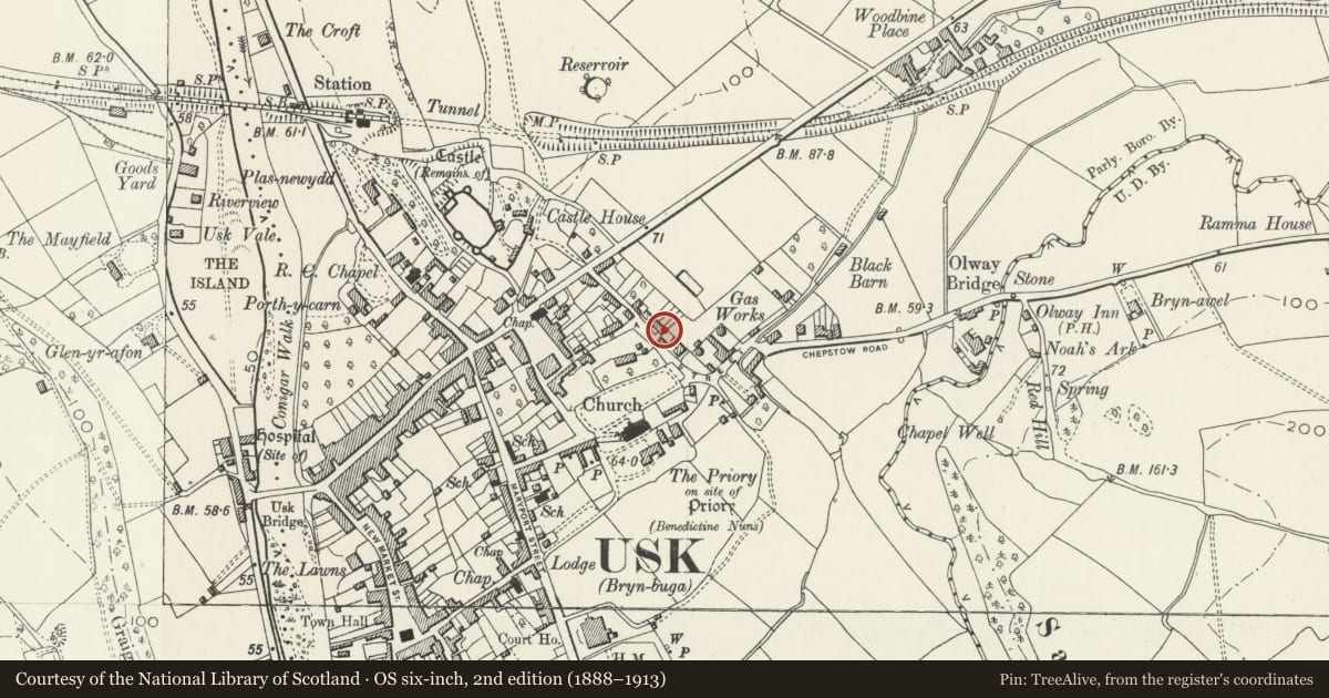
Slide toward Today to fade the historical sheet and see the modern map underneath.
David Rumsey Map Collection, Stanford LibrariesDavid Rumsey Map Collection, Stanford LibrariesDavid Rumsey Map Collection, Stanford LibrariesDavid Rumsey Map Collection, Stanford LibrariesDavid Rumsey Map Collection, Stanford Libraries
5 historical maps cover this location, the earliest the 1636 map "Cornubia : Devonia, Somersetus, Dorcestria, Wiltonia, Glocestria ..." (David Rumsey Map Collection, Stanford Libraries).
Historical maps covering this location
- 1636 · Cornubia : Devonia, Somersetus, Dorcestria, Wiltonia, Glocestria ... (David Rumsey Map Collection, Stanford Libraries)
- 1637 · The fourth table of England. Cornub. Devonia, Somerset etc. (David Rumsey Map Collection, Stanford Libraries)
- 1830 · V.3:11-15:XV.Britisches Reich. A. Kon: England. a. England ab sich: Shire:15-17, 33 (David Rumsey Map Collection, Stanford Libraries)
- 1895 · Sheet 11. Ordnance Survey of England and Wales. (David Rumsey Map Collection, Stanford Libraries)
- 1913 · Sheet 102. Newport. (David Rumsey Map Collection, Stanford Libraries)
Cadw's description
Location
House at end right of a terrace of four, NE of the priory.
History
Probably C16. Deep steep-pitched roof and masonry offset at left suggests an early origin and altered masonry, possibly from earlier timber-framing. Frontage appears early-mid C19. Was at one time two cottages. Sustained bomb damage at rear during the Second World War.
Exterior
House, attached at left. Roughcast rendered with deep-pitched slate roof, swept eaves and and corniced brick end stacks; asbestos roof to rear. Two-window range of small-pane casement glazing. Timber lintels. Centre right doorway with boarded door. A shallow offset at left.
Interior
Interior reported as retaining two staircases, one of which rises beside fireplace, possible evidence of upper cruck construction.
Reason for designation
Part of a good range of town houses retaining their character in a historically important position. Group value with adjacent houses.
Nearby in the register
- 29 Four Ash StreetDomesticunder 1 mi
- 27 Four Ash StreetDomesticunder 1 mi
- 23 Four Ash StreetDomesticunder 1 mi
- Monmouthshire House, including front iron railingsDomesticunder 1 mi
Other entries of the same register within about three miles of this one, by straight line.