Cof Cymru: National Historic Assets of Wales · Wales
Lamb House
Glasbury, Powys, Wales
A Grade II listed building in Glasbury, Powys, designated on 18 January 1996.
The record
- Designation
- Listed building, Grade II
- Broad class
- Domestic
- Date of designation
- 18 January 1996
- Locality
- Glasbury
- Community
- Glasbury
- Unitary authority
- Powys
- Country
- Wales
- Coordinates
- 52.04525, -3.20275
- Cadw reference
- 17180
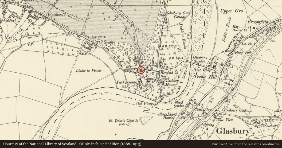
Slide toward Today to fade the historical sheet and see the modern map underneath.
David Rumsey Map Collection, Stanford LibrariesDavid Rumsey Map Collection, Stanford LibrariesDavid Rumsey Map Collection, Stanford LibrariesDavid Rumsey Map Collection, Stanford LibrariesDavid Rumsey Map Collection, Stanford Libraries
5 historical maps cover this location, the earliest the 1636 map "Cornubia : Devonia, Somersetus, Dorcestria, Wiltonia, Glocestria ..." (David Rumsey Map Collection, Stanford Libraries).
Historical maps covering this location
- 1636 · Cornubia : Devonia, Somersetus, Dorcestria, Wiltonia, Glocestria ... (David Rumsey Map Collection, Stanford Libraries)
- 1637 · Particular description of Wales. Cambria seu Wallia (David Rumsey Map Collection, Stanford Libraries)
- 1856 · 42. Brecon. (David Rumsey Map Collection, Stanford Libraries)
- 1896 · 214 Talgarth (Hills) (David Rumsey Map Collection, Stanford Libraries)
- 1901 · Sheet 14. (David Rumsey Map Collection, Stanford Libraries)
Cadw's description
Location
Located within the village of Glasbury, almost opposite the Maesllwch Arms Hotel. The main house is set at right angles with its gable close upon the road from Glasbury to Boughrood.
Exterior
House probably of the mid to late C18. Colourwashed rendering with a slate roof. One storey and attic, three bays, attached at the rear by a lower link to a further block set at right angles, the link containing the entrance. The main range comprised a living room divided by a timber framed partition from the parlour at the road end, with a service bay below the axial stack at the S end. Sixteen-paned sashes with timber lintels and similar windows in the three raised dormers, the centre one larger with a 20-paned sash. Rendered stacks at the parlour end and between hall and service bay, both with clayware pots.
Interior
Not accessible at the time of inspection (July 1995)
Reason for designation
Included for its group value with the Maesllwch Arms Hotel, near the centre of Glasbury village.
Nearby in the register
- GrangetonDomesticunder 1 mi
- Green HouseDomesticunder 1 mi
- Maesllwch Arms HotelCommercialunder 1 mi
- Former Stable and Coachhouse to Parc GwynneDomesticunder 1 mi
Other entries of the same register within about three miles of this one, by straight line.