Cof Cymru: National Historic Assets of Wales · Wales
Maesllwch Arms Hotel
Glasbury, Powys, Wales
A Grade II listed building in Glasbury, Powys, designated on 18 January 1996.
The record
- Designation
- Listed building, Grade II
- Broad class
- Commercial
- Date of designation
- 18 January 1996
- Locality
- Glasbury
- Community
- Glasbury
- Unitary authority
- Powys
- Country
- Wales
- Coordinates
- 52.04574, -3.20321
- Cadw reference
- 17179
Slide toward Today to fade the historical sheet and see the modern map underneath.
David Rumsey Map Collection, Stanford LibrariesDavid Rumsey Map Collection, Stanford LibrariesDavid Rumsey Map Collection, Stanford LibrariesDavid Rumsey Map Collection, Stanford LibrariesDavid Rumsey Map Collection, Stanford Libraries
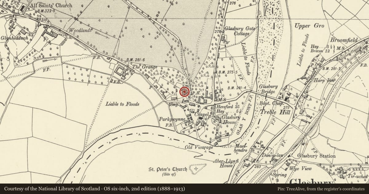
5 historical maps cover this location, the earliest the 1636 map "Cornubia : Devonia, Somersetus, Dorcestria, Wiltonia, Glocestria ..." (David Rumsey Map Collection, Stanford Libraries).
Historical maps covering this location
- 1636 · Cornubia : Devonia, Somersetus, Dorcestria, Wiltonia, Glocestria ... (David Rumsey Map Collection, Stanford Libraries)
- 1637 · Particular description of Wales. Cambria seu Wallia (David Rumsey Map Collection, Stanford Libraries)
- 1856 · 42. Brecon. (David Rumsey Map Collection, Stanford Libraries)
- 1896 · 214 Talgarth (Hills) (David Rumsey Map Collection, Stanford Libraries)
- 1901 · Sheet 14. (David Rumsey Map Collection, Stanford Libraries)
Cadw's description
Location
The hotel is located on the N side of the village behind a large forecourt and against the former driveway to Maesllwch Castle.
Exterior
A hotel of the late C18. Whitewashed stone rubble with slate roofs. The building is now of U-plan, with the primary building on the W side facing E, and its stable and coachhouse range added, attached at the N corner. The E range is a further later addition, enclosing the yard. The W range has a symmetrical 3-bay front, of 2 storeys and attic. Central through stair hall and main reception room to left; the accommodation to the right altered. Gable stacks. Six-panelled door with a 4-paned overlight within a timber doorcase and bracketed canopy. Tripartite 12-paned sashes to bays either side, having moulded surrounds. Twelve-paned sashes to the first floor. The central bay is gabled and has a lunette window. All openings have timber lintels. Boxed eaves. The stable-coachhouse range has been altered in the C20 by a front extension to form a dining room. Door at E end. The E range is later, and has lean-to structures on the S and E sides.
Interior
The stair within the hallway of the W range is early C19, with moulded handrail and stick balusters.
Reason for designation
Included for the special interest of the primary building, a good example of the Glasbury style of larger late C18-early C19 house.
Nearby in the register
- Lamb HouseDomesticunder 1 mi
- GrangetonDomesticunder 1 mi
- Green HouseDomesticunder 1 mi
- Former Stable and Coachhouse to Parc GwynneDomesticunder 1 mi
Other entries of the same register within about three miles of this one, by straight line.