Cof Cymru: National Historic Assets of Wales · Wales
Former Stable and Coachhouse to Parc Gwynne
Glasbury, Powys, Wales
A Grade II listed building in Glasbury, Powys, designated on 18 January 1996.
The record
- Designation
- Listed building, Grade II
- Broad class
- Domestic
- Date of designation
- 18 January 1996
- Locality
- Glasbury
- Community
- Glasbury
- Unitary authority
- Powys
- Country
- Wales
- Coordinates
- 52.04461, -3.20276
- Cadw reference
- 17175
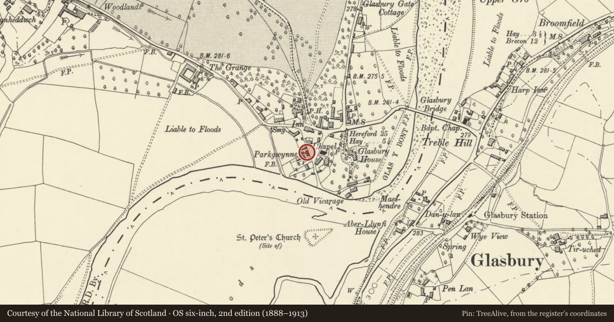
Slide toward Today to fade the historical sheet and see the modern map underneath.
David Rumsey Map Collection, Stanford LibrariesDavid Rumsey Map Collection, Stanford LibrariesDavid Rumsey Map Collection, Stanford LibrariesDavid Rumsey Map Collection, Stanford LibrariesDavid Rumsey Map Collection, Stanford Libraries
5 historical maps cover this location, the earliest the 1636 map "Cornubia : Devonia, Somersetus, Dorcestria, Wiltonia, Glocestria ..." (David Rumsey Map Collection, Stanford Libraries).
Historical maps covering this location
- 1636 · Cornubia : Devonia, Somersetus, Dorcestria, Wiltonia, Glocestria ... (David Rumsey Map Collection, Stanford Libraries)
- 1637 · Particular description of Wales. Cambria seu Wallia (David Rumsey Map Collection, Stanford Libraries)
- 1856 · 42. Brecon. (David Rumsey Map Collection, Stanford Libraries)
- 1896 · 214 Talgarth (Hills) (David Rumsey Map Collection, Stanford Libraries)
- 1901 · Sheet 14. (David Rumsey Map Collection, Stanford Libraries)
Cadw's description
Location
The coachhouse lies between the Green and Parc Gwynne house, backing on to the Green.
Exterior
Coachhouse, c.1860-1870, now a dwelling. Red brick with 3-courses of intermittent blue and yellow brick banding. Slate roof with wide eaves. Two storeys, 3 bays, the central bay facing the Green set slightly forward and gabled, with cusped bargeboards with a central pendant. Late C20 round headed window to ground floor, and circular window above, the voussoirs composed of alternating red and yellow brick. Gable ends have similar cusped bargeboards. Three small roundels at high level on the elevation facing the house wing. Carefully restored and adapted c.1975
Reason for designation
Included as of group value with the listed Parc Gwynne, and with other listed buildings in the Conservation Area around the Green.
Nearby in the register
- Parc GwynneDomesticunder 1 mi
- Green HouseDomesticunder 1 mi
- Green CottagesDomesticunder 1 mi
- Old Police CottageDomesticunder 1 mi
Other entries of the same register within about three miles of this one, by straight line.