Cof Cymru: National Historic Assets of Wales · Wales
Grangeton
Glasbury, Powys, Wales
A Grade II listed building in Glasbury, Powys, designated on 18 January 1996.
The record
- Designation
- Listed building, Grade II
- Broad class
- Domestic
- Date of designation
- 18 January 1996
- Locality
- Glasbury
- Community
- Glasbury
- Unitary authority
- Powys
- Country
- Wales
- Coordinates
- 52.04533, -3.20227
- Cadw reference
- 17178
Slide toward Today to fade the historical sheet and see the modern map underneath.
David Rumsey Map Collection, Stanford LibrariesDavid Rumsey Map Collection, Stanford LibrariesDavid Rumsey Map Collection, Stanford LibrariesDavid Rumsey Map Collection, Stanford LibrariesDavid Rumsey Map Collection, Stanford Libraries
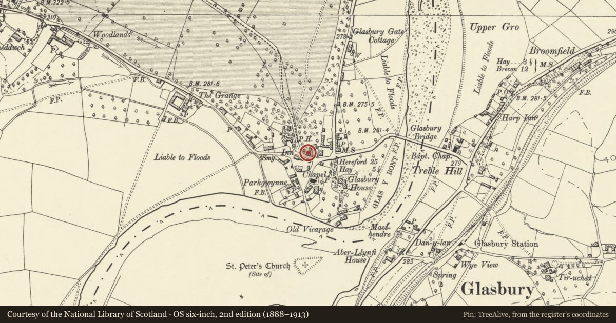
5 historical maps cover this location, the earliest the 1636 map "Cornubia : Devonia, Somersetus, Dorcestria, Wiltonia, Glocestria ..." (David Rumsey Map Collection, Stanford Libraries).
Historical maps covering this location
- 1636 · Cornubia : Devonia, Somersetus, Dorcestria, Wiltonia, Glocestria ... (David Rumsey Map Collection, Stanford Libraries)
- 1637 · Particular description of Wales. Cambria seu Wallia (David Rumsey Map Collection, Stanford Libraries)
- 1856 · 42. Brecon. (David Rumsey Map Collection, Stanford Libraries)
- 1896 · 214 Talgarth (Hills) (David Rumsey Map Collection, Stanford Libraries)
- 1901 · Sheet 14. (David Rumsey Map Collection, Stanford Libraries)
Cadw's description
Location
The house is located within the village, to the E of the Maesllwch Arms Hotel placed with the gable to the road, the main elevation facing E.
Exterior
House of c.1800, possibly with earlier origins suggested by the placing with gable to road. Colourwashed rubble with a slate roof. Two storeys and attic, 3 bays. Central half-glazed door. Windows either side enlarged in the C20 but two small 4-paned sash windows to the first floor with segmental brick arches. At the centre, a raised gable with lunette window. Gable stacks. To the rear, C19 one-storey and attic wing with a blocked door and two C20 2-light windows with pecked ashlar jambs and lintels.
Interior
Not accessible at time of inspection (July 1995)
Reason for designation
Included as one of the large houses with a gable to the central bay built in Glasbury at the turn of the C19. Of group value in the village.
Nearby in the register
- Lamb HouseDomesticunder 1 mi
- Green HouseDomesticunder 1 mi
- Glasbury United Reformed ChapelReligious, Ritual and Funeraryunder 1 mi
- Maesllwch Arms HotelCommercialunder 1 mi
Other entries of the same register within about three miles of this one, by straight line.