Cof Cymru: National Historic Assets of Wales · Wales
Upper Llangoed Farmhouse
Bronllys, Powys, Wales
A Grade II listed building in LLangoed, Bronllys, Powys, designated on 15 December 1995.
The record
- Designation
- Listed building, Grade II
- Broad class
- Domestic
- Date of designation
- 15 December 1995
- Locality
- LLangoed
- Community
- Bronllys
- Unitary authority
- Powys
- Country
- Wales
- Coordinates
- 52.04520, -3.29467
- Cadw reference
- 16691
Slide toward Today to fade the historical sheet and see the modern map underneath.
David Rumsey Map Collection, Stanford LibrariesDavid Rumsey Map Collection, Stanford LibrariesDavid Rumsey Map Collection, Stanford LibrariesDavid Rumsey Map Collection, Stanford LibrariesDavid Rumsey Map Collection, Stanford Libraries
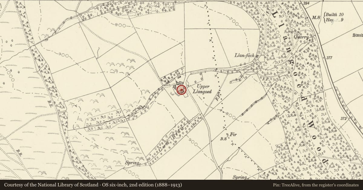
5 historical maps cover this location, the earliest the 1608 map "(13) Cambriae Typus." (David Rumsey Map Collection, Stanford Libraries).
Historical maps covering this location
- 1608 · (13) Cambriae Typus. (David Rumsey Map Collection, Stanford Libraries)
- 1636 · Cornubia : Devonia, Somersetus, Dorcestria, Wiltonia, Glocestria ... (David Rumsey Map Collection, Stanford Libraries)
- 1856 · 42. Brecon. (David Rumsey Map Collection, Stanford Libraries)
- 1896 · 214 Talgarth (Hills) (David Rumsey Map Collection, Stanford Libraries)
- 1901 · Sheet 14. (David Rumsey Map Collection, Stanford Libraries)
Cadw's description
Location
Located on high ground above Llyswen, on the minor road from Llangoed to Brechfa and Llandefalle. The farmhouse sits on a bank, to the S of the farm buildings.
Exterior
Exterior: Two-storey farmhouse of early-mid C19. Colourwashed stone with slate roof. 3 bays, with a 4-bay rear wing on the left (S side), and a 1-bay gabled rear wing on the N side. Elevation to road symmetrical, with central half-glazed door and overlight. Twenty-paned sashes to ground floor, 16-paned to first floor except for a replaced window to left, deeply set in segmental headed openings. Gables stacks and small-pane gable end windows. Brick dentilled eaves. Rear wing on N has 20-pane sashes and a semicircular opening. The southern wing has two boarded doors, 6-paned windows and four louvred vents to the attic storage area under the eaves.
Interior not accessible at the time of inspection (May 1995).
Included as a well preserved farmhouse of the earlier C19.
Nearby in the register
- Llangoed FarmhouseDomesticunder 1 mi
- Engine House at Llangoed HallIndustrialunder 1 mi
- Llangoed Cottage WorkshopDomesticunder 1 mi
- Gatepiers at Llangoed HallDomesticunder 1 mi
Other entries of the same register within about three miles of this one, by straight line.