Cof Cymru: National Historic Assets of Wales · Wales
Gates and gate-piers to W driveway to Cresselly House
Jeffreyston, Pembrokeshire, Wales
A Grade II listed building in Cresselly, Jeffreyston, Pembrokeshire, designated on 28 April 1995.
The record
- Designation
- Listed building, Grade II
- Broad class
- Domestic
- Date of designation
- 28 April 1995
- Locality
- Cresselly
- Community
- Jeffreyston
- Unitary authority
- Pembrokeshire
- Country
- Wales
- Coordinates
- 51.72334, -4.80712
- Cadw reference
- 15927
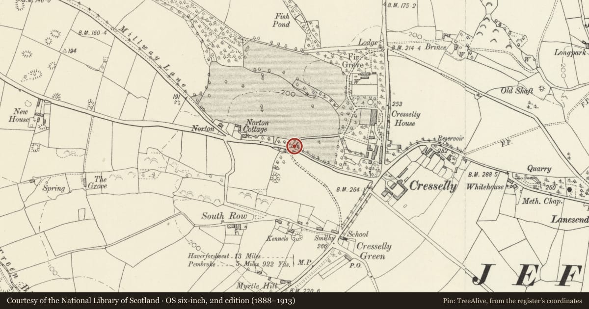
Slide toward Today to fade the historical sheet and see the modern map underneath.
David Rumsey Map Collection, Stanford LibrariesDavid Rumsey Map Collection, Stanford LibrariesDavid Rumsey Map Collection, Stanford LibrariesDavid Rumsey Map Collection, Stanford LibrariesDavid Rumsey Map Collection, Stanford Libraries
5 historical maps cover this location, the earliest the 1636 map "Cornubia : Devonia, Somersetus, Dorcestria, Wiltonia, Glocestria ..." (David Rumsey Map Collection, Stanford Libraries).
Historical maps covering this location
- 1636 · Cornubia : Devonia, Somersetus, Dorcestria, Wiltonia, Glocestria ... (David Rumsey Map Collection, Stanford Libraries)
- 1637 · The fourth table of England. Cornub. Devonia, Somerset etc. (David Rumsey Map Collection, Stanford Libraries)
- 1891 · Sheet 10. Ordnance Survey of England and Wales. . (David Rumsey Map Collection, Stanford Libraries)
- 1898 · 228 Haverfordwest (Hills) (David Rumsey Map Collection, Stanford Libraries)
- 1901 · Sheet 13. (David Rumsey Map Collection, Stanford Libraries)
Cadw's description
Location
Opposite the W Lodge; set back slightly from the N side of the by-road to Cresswell Quay from the A4075 at Cresselly.
History
Contemporary with the W Lodge which was built c.1900, although to the same design as the 1860's lodges, gates and gate-piers that were part of the estate improvements by Clarke and Holland of Newmarket for Lady Catherine Allen. Cresselly House was built c.1770 by John Bartlett Allen.
Exterior
Double set of square, ashlar, gate-piers on plinths with pyramidal caps (lower to outer pair) and ball finials. Shields to inner pair with metal crests (missing) of the Allen family of Cresselly, the dove and the olive branch. Double ironwork spear gates to driveway and similar fixed ironwork railings to outer openings. Quadrant rubble flanking walls.
Reason for designation
Listed as part of this well-preserved estate.
Group value.
Nearby in the register
- West LodgeDomesticunder 1 mi
- Indoor roller-skating rink to W of Stable Courtyard at Creselly HouseDomesticunder 1 mi
- Outbuilding to SW of Stable Courtyard at Cresselly HouseDomesticunder 1 mi
- Stable Range to W side of Stable Courtyard at Creselly HouseDomesticunder 1 mi
Other entries of the same register within about three miles of this one, by straight line.