Cof Cymru: National Historic Assets of Wales · Wales
Tanybryn
Dinas Cross, Pembrokeshire, Wales
A Grade II listed building in Dinas Cross, Pembrokeshire, designated on 17 November 1994.
The record
- Designation
- Listed building, Grade II
- Broad class
- Domestic
- Date of designation
- 17 November 1994
- Locality
- Dinas Cross
- Community
- Dinas Cross
- Unitary authority
- Pembrokeshire
- Country
- Wales
- Coordinates
- 52.01584, -4.88963
- Cadw reference
- 14940
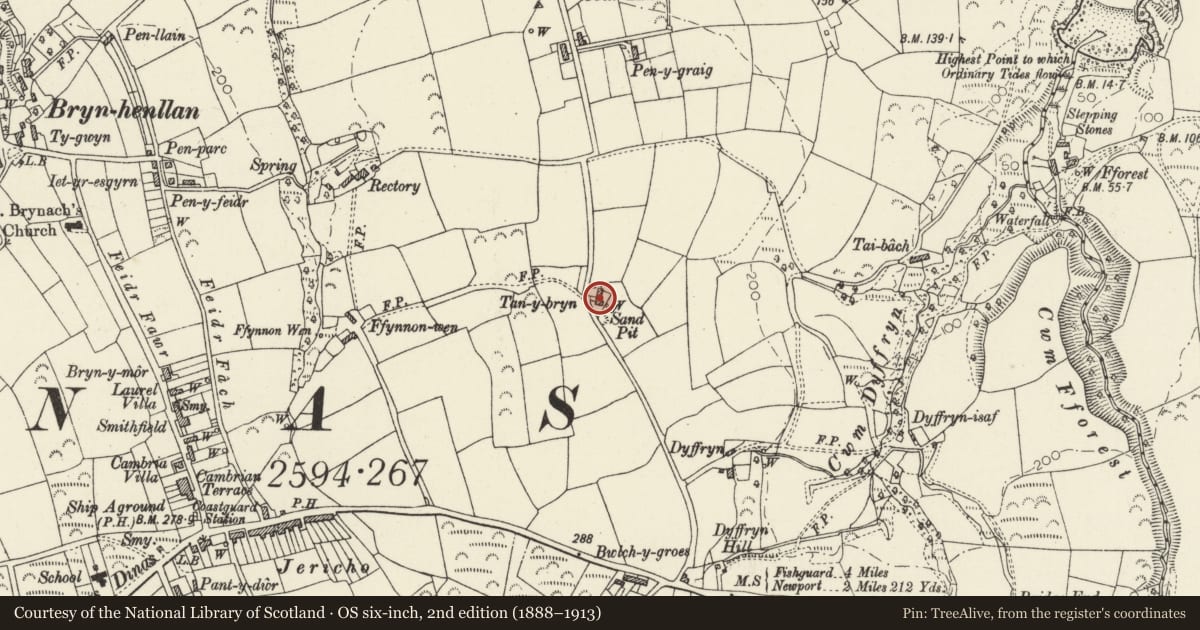
Slide toward Today to fade the historical sheet and see the modern map underneath.
David Rumsey Map Collection, Stanford LibrariesDavid Rumsey Map Collection, Stanford LibrariesDavid Rumsey Map Collection, Stanford LibrariesDavid Rumsey Map Collection, Stanford LibrariesDavid Rumsey Map Collection, Stanford Libraries
5 historical maps cover this location, the earliest the 1608 map "(13) Cambriae Typus." (David Rumsey Map Collection, Stanford Libraries).
Historical maps covering this location
- 1608 · (13) Cambriae Typus. (David Rumsey Map Collection, Stanford Libraries)
- 1891 · Sheet 10. Ordnance Survey of England and Wales. . (David Rumsey Map Collection, Stanford Libraries)
- 1898 · 210 Cardigan (Hills) (David Rumsey Map Collection, Stanford Libraries)
- 1898 · 210 Cardigan (Outline) (David Rumsey Map Collection, Stanford Libraries)
- 1901 · Sheet 13. (David Rumsey Map Collection, Stanford Libraries)
Cadw's description
Location
Situated on E side of lane from Dinas Cross to Cwym-yr-Eglwys, some 0.5km N of Dinas Cross.
History
Earlier C19 farmhouse, probably replacing single-storey house, now outbuilding to N.
Exterior
Whitewashed rubble stone with imitation slate roof and stone end stacks. Two-storey three-window range of hornless 12-pane sashes, under eaves above, larger below with centre door and 4-panel door with overlight. Stone voussoirs to ground floor partly replaced in brick. Painted slate sills. Single-storey rendered addition to S. Single-storey whitewashed rubble stone former cottage to N with asbestos roof. Window, door and window to front, timber lintel to door, brick renewed heads to windows. Outshut rear of house with catslide roof over eaves-breaking stair-window and added 2-storey later C19 SE rear wing, said to be dated JLS 1886 on beam.
Reason for designation
Included as little altered example of earlier C19 House, marked 1841 Tithe Map.
Nearby in the register
- The CrossDomesticunder 1 mi
- Gedeon Independent ChapelReligious, Ritual and Funeraryunder 1 mi
- Castle Green including Front RailingsDomesticunder 1 mi
- Ty CambriaDomesticunder 1 mi
Other entries of the same register within about three miles of this one, by straight line.