Cof Cymru: National Historic Assets of Wales · Wales
Glandwr (St. Asaph Cricket & Social Club)
St. Asaph, Denbighshire, Wales
A Grade II listed building in St. Asaph, Denbighshire, designated on 24 November 1987.
The record
- Designation
- Listed building, Grade II
- Broad class
- Recreational
- Date of designation
- 24 November 1987
- Community
- St. Asaph
- Unitary authority
- Denbighshire
- Country
- Wales
- Coordinates
- 53.25966, -3.45114
- Cadw reference
- 1478
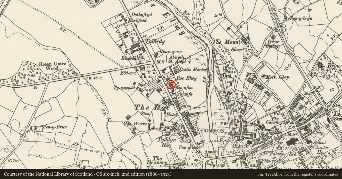
Slide toward Today to fade the historical sheet and see the modern map underneath.
David Rumsey Map Collection, Stanford LibrariesDavid Rumsey Map Collection, Stanford LibrariesLlyfrgell Genedlaethol Cymru – The National Library of WalesDavid Rumsey Map Collection, Stanford LibrariesDavid Rumsey Map Collection, Stanford Libraries
5 historical maps cover this location, the earliest the 1608 map "(13) Cambriae Typus." (David Rumsey Map Collection, Stanford Libraries).
Historical maps covering this location
- 1608 · (13) Cambriae Typus. (David Rumsey Map Collection, Stanford Libraries)
- 1795 · To Sir Watkin Williams-Wynn Bart ... the map of the six counties of North Wales is most… (Llyfrgell Genedlaethol Cymru – The National Library of Wales)
- 1830 · V.3:11-15:XV. Britisches Reich. A. Kon: England. b. Frstenthum Wales: Shire: 37-40 (David Rumsey Map Collection, Stanford Libraries)
- 1883 · Watershed map England, Wales 3. (David Rumsey Map Collection, Stanford Libraries)
- 1901 · Sheet 9 and 10. (David Rumsey Map Collection, Stanford Libraries)
Cadw's description
Location
Detached and set back from the road behind the forecourt near the N end of the road.
History
Mid C19 (shown on 1854-5 map)
Exterior
Llate Georgian 2-storey, 3-window roughcast front with plinth; attic storey to advanced and gabled central bay. Steep slate roof with overhanging eaves and plain bargeboards to gable. Horned sash window to attic, small pane sash windows to 1st and ground floors; blind upper sash to left hand 1st floor window. Tripartite windows to ground floor flanking central arched entrance with painted broad architrave; modern panelled door. Rendered right end wall with arched headed sash window to attic. Twin gabled left end with arched headed sash and 1st floor oriel. Cross and parallel ranges to rear with brick gable to centre; outside rear staircase.
Subsequently damaged by fire (Autumn 1987).
Nearby in the register
- Min-AfonDomesticunder 1 mi
- SuncotDomesticunder 1 mi
- Talardy HotelCommercialunder 1 mi
- Walled Garden at Talardy HotelDomesticunder 1 mi
Other entries of the same register within about three miles of this one, by straight line.