Cof Cymru: National Historic Assets of Wales · Wales
Springfield (Deaf and Dumb Mission)
Uplands, Swansea, Wales
A Grade II listed building in Uplands, Swansea, designated on 25 July 1994.
The record
- Designation
- Listed building, Grade II
- Broad class
- Domestic
- Date of designation
- 25 July 1994
- Community
- Uplands
- Unitary authority
- Swansea
- Country
- Wales
- Coordinates
- 51.62070, -3.96108
- Cadw reference
- 14584
Slide toward Today to fade the historical sheet and see the modern map underneath.
David Rumsey Map Collection, Stanford LibrariesDavid Rumsey Map Collection, Stanford LibrariesDavid Rumsey Map Collection, Stanford LibrariesDavid Rumsey Map Collection, Stanford LibrariesDavid Rumsey Map Collection, Stanford Libraries
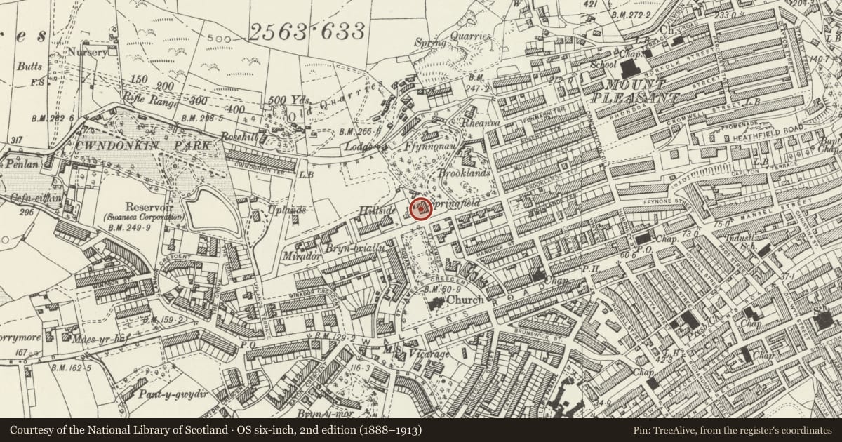
5 historical maps cover this location, the earliest the 1636 map "Cornubia : Devonia, Somersetus, Dorcestria, Wiltonia, Glocestria ..." (David Rumsey Map Collection, Stanford Libraries).
Historical maps covering this location
- 1636 · Cornubia : Devonia, Somersetus, Dorcestria, Wiltonia, Glocestria ... (David Rumsey Map Collection, Stanford Libraries)
- 1637 · The fourth table of England. Cornub. Devonia, Somerset etc. (David Rumsey Map Collection, Stanford Libraries)
- 1865 · England and Wales. England No. 6. (David Rumsey Map Collection, Stanford Libraries)
- 1891 · Sheet 10. Ordnance Survey of England and Wales. . (David Rumsey Map Collection, Stanford Libraries)
- 1897 · 247 Swansea (Hills) (David Rumsey Map Collection, Stanford Libraries)
Cadw's description
Location
Opposite N end of St James’ Gardens, to E of Bryn-cerrig.
History
House of circa 1870.
Exterior
Two storeys, pale ashlar, slate roof, tall chimneys to ends (but 2 central chimneys to ridge cut down), stone brackets to eaves, mainly horned sash glazing without glazing bars. South front has large 2-storey splayed bay to each end, first floor windows in shallow moulded surrounds, projecting sill band on corbels. Taller ground floor windows each have architrave with bracketed pediment and panels at frieze level. Between bays, wall has been cement rendered, single first floor window as in bays; on ground floor, former doorway (now window with modern glazing) has pediment on long brackets. Return to L has flat-roofed Doric porch, and 2 windows offset to side.
Reason for designation
Included as part of good group of mid Victorian domestic buildings in area, and for its contribution to townscape of conservation area on important site at top of E side of St James’ gardens.
Group value
Nearby in the register
- Beryn-CerrigDomesticunder 1 mi
- HillsideDomesticunder 1 mi
- The HawthornesDomesticunder 1 mi
- 22 St James GardensDomesticunder 1 mi
Other entries of the same register within about three miles of this one, by straight line.