Cof Cymru: National Historic Assets of Wales · Wales
Hillside
Uplands, Swansea, Wales
A Grade II listed building in Uplands, Swansea, designated on 25 July 1994.
The record
- Designation
- Listed building, Grade II
- Broad class
- Domestic
- Date of designation
- 25 July 1994
- Community
- Uplands
- Unitary authority
- Swansea
- Country
- Wales
- Coordinates
- 51.62045, -3.96225
- Cadw reference
- 14582
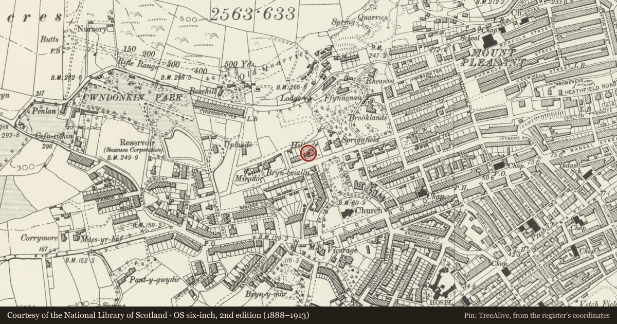
Slide toward Today to fade the historical sheet and see the modern map underneath.
David Rumsey Map Collection, Stanford LibrariesDavid Rumsey Map Collection, Stanford LibrariesDavid Rumsey Map Collection, Stanford LibrariesDavid Rumsey Map Collection, Stanford LibrariesDavid Rumsey Map Collection, Stanford Libraries
5 historical maps cover this location, the earliest the 1636 map "Cornubia : Devonia, Somersetus, Dorcestria, Wiltonia, Glocestria ..." (David Rumsey Map Collection, Stanford Libraries).
Historical maps covering this location
- 1636 · Cornubia : Devonia, Somersetus, Dorcestria, Wiltonia, Glocestria ... (David Rumsey Map Collection, Stanford Libraries)
- 1637 · The fourth table of England. Cornub. Devonia, Somerset etc. (David Rumsey Map Collection, Stanford Libraries)
- 1865 · England and Wales. England No. 6. (David Rumsey Map Collection, Stanford Libraries)
- 1891 · Sheet 10. Ordnance Survey of England and Wales. . (David Rumsey Map Collection, Stanford Libraries)
- 1897 · 247 Swansea (Hills) (David Rumsey Map Collection, Stanford Libraries)
Cadw's description
Location
To E of Devon Terrace, at top of W side with St James’ Gardens.
History
Italianate house of circa 1870.
Exterior
Brown stone with bathstone dressings, slate roofs, stone chimneys. Main front faces S; hipped roof, 2 stone chimneys on ridge projecting gabled bay with overhanging eaves, round-headed window with, on first floor 3-light window with strapwork over linking with similar ground floor window, via strapwork scrolls. Outer bays have on top floor broad 3-light mullioned window set at eaves; on first floor, three-light mullioned window with tall keystone and bracketed sill. On ground floor, three-light mullioned and transomed window. To L, flat-roofed extensions and fire escapes.
To R, belvedere tower has shallow pyramidal roof with pinnacle, bracketed eaves belvedere stage in bathstone, 3 round-headed windows to each side, tall keystones; 2 round windows to next stage, below these, tall window with round head, heraldic shield, and balcony; sloping buttresses.
E elevation of tower has, below pair of round windows, blind panel, and niche with roundel of lion’s head; to R of tower, gable with overhanging eaves, round-headed window to second floor, 2 windows to first floor, open porch, round-headed entrance doorway with 2-leaf doors; window to R.
Reason for designation
Included as part of good group of mid Victorian domestic buildings in area, and for its contribution to townscape of conservation area on important site at top of W side of St James’ gardens.
Group value.
Nearby in the register
- Devon TerraceDomesticunder 1 mi
- Devon TerraceDomesticunder 1 mi
- Devon TerraceDomesticunder 1 mi
- The HawthornesDomesticunder 1 mi
Other entries of the same register within about three miles of this one, by straight line.