Cof Cymru: National Historic Assets of Wales · Wales
Beryn-Cerrig
Uplands, Swansea, Wales
A Grade II listed building in Uplands, Swansea, designated on 25 July 1994.
The record
- Designation
- Listed building, Grade II
- Broad class
- Domestic
- Date of designation
- 25 July 1994
- Community
- Uplands
- Unitary authority
- Swansea
- Country
- Wales
- Coordinates
- 51.62059, -3.96152
- Cadw reference
- 14583
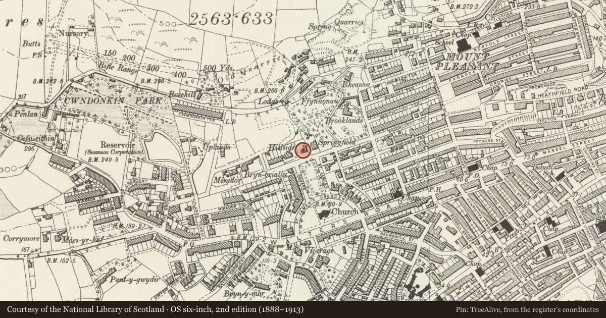
Slide toward Today to fade the historical sheet and see the modern map underneath.
David Rumsey Map Collection, Stanford LibrariesDavid Rumsey Map Collection, Stanford LibrariesDavid Rumsey Map Collection, Stanford LibrariesDavid Rumsey Map Collection, Stanford LibrariesDavid Rumsey Map Collection, Stanford Libraries
5 historical maps cover this location, the earliest the 1636 map "Cornubia : Devonia, Somersetus, Dorcestria, Wiltonia, Glocestria ..." (David Rumsey Map Collection, Stanford Libraries).
Historical maps covering this location
- 1636 · Cornubia : Devonia, Somersetus, Dorcestria, Wiltonia, Glocestria ... (David Rumsey Map Collection, Stanford Libraries)
- 1637 · The fourth table of England. Cornub. Devonia, Somerset etc. (David Rumsey Map Collection, Stanford Libraries)
- 1865 · England and Wales. England No. 6. (David Rumsey Map Collection, Stanford Libraries)
- 1891 · Sheet 10. Ordnance Survey of England and Wales. . (David Rumsey Map Collection, Stanford Libraries)
- 1897 · 247 Swansea (Hills) (David Rumsey Map Collection, Stanford Libraries)
Cadw's description
Location
Opposite N end of St James’ Gardens.
History
House of circa 1870.
Exterior
Two storeys; rubble with bathstone dressings, tiled hipped roof, group of 4 cylindrical brick chimneys to ridge and second group to L. To L, square bathstone bay, hipped roof, 4-light mullioned and transomed window to first floor, on ground floor, similar window with shouldered heads to lights. To R, larger square rubble bay, hipped roof, two 2-light mullioned and transomed windows to first floor, on ground floor, two similar windows with shouldered heads to lights. To centre, on first floor, single 2-light mullioned and transomed window; on ground floor, pierced balustrade to balcony over loggia with three round arches; beneath loggia, 2-light mullioned and transomed window with shouldered heads to lights.
Reason for designation
Included for group value with adjacent listed buildings.
Group value.
Nearby in the register
- Springfield (Deaf and Dumb Mission)Domesticunder 1 mi
- HillsideDomesticunder 1 mi
- The HawthornesDomesticunder 1 mi
- Devon TerraceDomesticunder 1 mi
Other entries of the same register within about three miles of this one, by straight line.