Cof Cymru: National Historic Assets of Wales · Wales
Farthings Old Wine House
Cowbridge with Llanblethian, Vale of Glamorgan, Wales
A Grade II listed building in Cowbridge, Cowbridge with Llanblethian, Vale of Glamorgan, designated on 3 February 1981.
The record
- Designation
- Listed building, Grade II
- Broad class
- Commercial
- Date of designation
- 3 February 1981
- Locality
- Cowbridge
- Community
- Cowbridge with Llanblethian
- Unitary authority
- Vale of Glamorgan
- Country
- Wales
- Coordinates
- 51.46211, -3.44983
- Cadw reference
- 13227
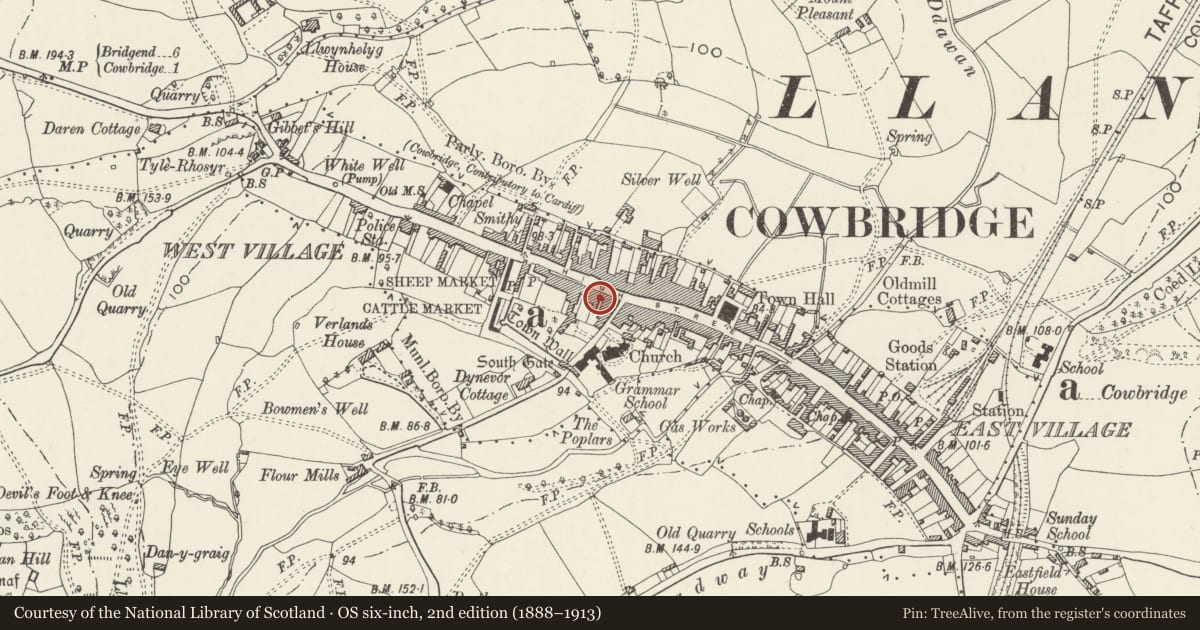
Slide toward Today to fade the historical sheet and see the modern map underneath.
David Rumsey Map Collection, Stanford LibrariesDavid Rumsey Map Collection, Stanford LibrariesDavid Rumsey Map Collection, Stanford LibrariesDavid Rumsey Map Collection, Stanford LibrariesDavid Rumsey Map Collection, Stanford Libraries
5 historical maps cover this location, the earliest the 1636 map "Cornubia : Devonia, Somersetus, Dorcestria, Wiltonia, Glocestria ..." (David Rumsey Map Collection, Stanford Libraries).
Historical maps covering this location
- 1636 · Cornubia : Devonia, Somersetus, Dorcestria, Wiltonia, Glocestria ... (David Rumsey Map Collection, Stanford Libraries)
- 1637 · The fourth table of England. Cornub. Devonia, Somerset etc. (David Rumsey Map Collection, Stanford Libraries)
- 1865 · England and Wales. England No. 6. (David Rumsey Map Collection, Stanford Libraries)
- 1897 · 262 Pontypridd (Hills) (David Rumsey Map Collection, Stanford Libraries)
- 1897 · 262 Pontypridd (Outline) (David Rumsey Map Collection, Stanford Libraries)
Cadw's description
Location
About 60m W of junction with Church Street.
History
C18. A medieval two-light stone window brought here from the former 75 High Street, a now demolished late medieval house.
Exterior
Three storey house with three bay front elevation of stone rubble, exposed in later C20. Slate roof with stone flanking stacks. Ground floor front wall with central neo-Georgian doorway flanked to each side by wide later C20 bow window with small panes. On second floor, square 16-pane sash windows; on first floor, 12-pane sash windows. To left hand, single storey bay abutting front wall of no 52 at its rear; slate roof, stone rubble front and side walls and round-headed doorway.
Reason for designation
Well-preserved C18 house on prominent site in conservation area. Group value with adjacent listed buildings.
Nearby in the register
- 56 High StreetCommercialunder 1 mi
- 52 High StreetCommercialunder 1 mi
- 58 High StreetDomesticunder 1 mi
- 50 High StreetCommercialunder 1 mi
Other entries of the same register within about three miles of this one, by straight line.