Cof Cymru: National Historic Assets of Wales · Wales
50 High Street
Cowbridge with Llanblethian, Vale of Glamorgan, Wales
A Grade II listed building in Cowbridge, Cowbridge with Llanblethian, Vale of Glamorgan, designated on 10 July 1968.
The record
- Designation
- Listed building, Grade II
- Broad class
- Commercial
- Date of designation
- 10 July 1968
- Locality
- Cowbridge
- Community
- Cowbridge with Llanblethian
- Unitary authority
- Vale of Glamorgan
- Country
- Wales
- Coordinates
- 51.46205, -3.44955
- Cadw reference
- 13225
Slide toward Today to fade the historical sheet and see the modern map underneath.
David Rumsey Map Collection, Stanford LibrariesDavid Rumsey Map Collection, Stanford LibrariesDavid Rumsey Map Collection, Stanford LibrariesDavid Rumsey Map Collection, Stanford LibrariesDavid Rumsey Map Collection, Stanford Libraries
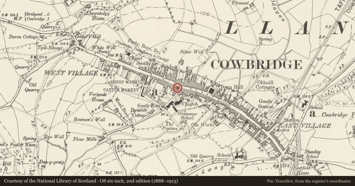
5 historical maps cover this location, the earliest the 1636 map "Cornubia : Devonia, Somersetus, Dorcestria, Wiltonia, Glocestria ..." (David Rumsey Map Collection, Stanford Libraries).
Historical maps covering this location
- 1636 · Cornubia : Devonia, Somersetus, Dorcestria, Wiltonia, Glocestria ... (David Rumsey Map Collection, Stanford Libraries)
- 1637 · The fourth table of England. Cornub. Devonia, Somerset etc. (David Rumsey Map Collection, Stanford Libraries)
- 1865 · England and Wales. England No. 6. (David Rumsey Map Collection, Stanford Libraries)
- 1897 · 262 Pontypridd (Hills) (David Rumsey Map Collection, Stanford Libraries)
- 1897 · 262 Pontypridd (Outline) (David Rumsey Map Collection, Stanford Libraries)
Cadw's description
Location
On corner with Church Street.
History
Probably C17 origins, altered in C18 or early C19.
Exterior
Two storeys and attic. Exposed local rubble (formerly stuccoed). Slate roof. Stone stack at each end. On ground floor large modern shop front.
Beneath shop front towards R, semi-circular arched central house doorway with C19 fanlight with radiating tracery and modern door. On first floor,12-pane sashes to middle and to right hand; a paired sash, set lower, to left hand. Three (modern) gabled dormers to attic. East gable end with projecting corbelled chimney; rear elevation with remains of an external chimney breast with full height stair chamber projecting against it; low two storey rear wing to south.
Interior
Said to retain winding stone stair to SW of front wing on ground floor; plain ceiling beam on North-South alignment with one chamfered beam in first floor room; early to mid C19 fireplace with reeded surround and angle roundels in east first floor room.
Reason for designation
Included for group value with other buildings in High Street.
Nearby in the register
- 52 High StreetCommercialunder 1 mi
- Farthings Old Wine HouseCommercialunder 1 mi
- Duke of Wellington PH including Rear Wing to Church StreetCommercialunder 1 mi
- 56 High StreetCommercialunder 1 mi
Other entries of the same register within about three miles of this one, by straight line.