Cof Cymru: National Historic Assets of Wales · Wales
Xantippe
Cowbridge with Llanblethian, Vale of Glamorgan, Wales
A Grade II listed building in Cowbridge, Cowbridge with Llanblethian, Vale of Glamorgan, designated on 3 February 1981.
The record
- Designation
- Listed building, Grade II
- Broad class
- Commercial
- Date of designation
- 3 February 1981
- Locality
- Cowbridge
- Community
- Cowbridge with Llanblethian
- Unitary authority
- Vale of Glamorgan
- Country
- Wales
- Coordinates
- 51.46211, -3.44842
- Cadw reference
- 13206
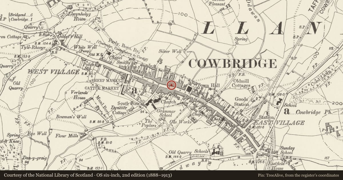
Slide toward Today to fade the historical sheet and see the modern map underneath.
David Rumsey Map Collection, Stanford LibrariesDavid Rumsey Map Collection, Stanford LibrariesDavid Rumsey Map Collection, Stanford LibrariesDavid Rumsey Map Collection, Stanford LibrariesDavid Rumsey Map Collection, Stanford Libraries
5 historical maps cover this location, the earliest the 1636 map "Cornubia : Devonia, Somersetus, Dorcestria, Wiltonia, Glocestria ..." (David Rumsey Map Collection, Stanford Libraries).
Historical maps covering this location
- 1636 · Cornubia : Devonia, Somersetus, Dorcestria, Wiltonia, Glocestria ... (David Rumsey Map Collection, Stanford Libraries)
- 1637 · The fourth table of England. Cornub. Devonia, Somerset etc. (David Rumsey Map Collection, Stanford Libraries)
- 1865 · England and Wales. England No. 6. (David Rumsey Map Collection, Stanford Libraries)
- 1897 · 262 Pontypridd (Hills) (David Rumsey Map Collection, Stanford Libraries)
- 1897 · 262 Pontypridd (Outline) (David Rumsey Map Collection, Stanford Libraries)
Cadw's description
Location
The right hand of a group of 3 gabled buildings about 100m W of Town Hall.
History
C17 origins; mid C19 pilastered facade recently restored.
Exterior
Three storeys. Two window gabled facade with stucco covering. Cornice; end pilasters. On second and first floor, two 12-pane sash windows in architraves. On ground floor, shopfront with central doorway flanked by display windows all under classicising fascia board.
Interior
Inside, in rear part of ground floor shop, plastered ceiling divided into panels by partly stopped and moulded wooden beams, C17 probably; two panels wide and three deep. Similar moulded beams in front first floor room. Rear first floor room with probably early C17 hooded fireplace on SE wall and two heavy chamfered beams. Six reeded panel door. Rear NW wing also with massive beams.
Reason for designation
Well-restored building of C17 origins on High Street. Group value with adjacent listed buildings.
Nearby in the register
- Lloyds ChemistCommercialunder 1 mi
- Nos. 35, 35a & 35b High StreetCommercialunder 1 mi
- 43 High StreetCommercialunder 1 mi
- Lloyds BankCommercialunder 1 mi
Other entries of the same register within about three miles of this one, by straight line.