Cof Cymru: National Historic Assets of Wales · Wales
Nos. 35, 35a & 35b High Street
Cowbridge with Llanblethian, Vale of Glamorgan, Wales
A Grade II listed building in Cowbridge, Cowbridge with Llanblethian, Vale of Glamorgan, designated on 3 February 1981.
The record
- Designation
- Listed building, Grade II
- Broad class
- Commercial
- Date of designation
- 3 February 1981
- Locality
- Cowbridge
- Community
- Cowbridge with Llanblethian
- Unitary authority
- Vale of Glamorgan
- Country
- Wales
- Coordinates
- 51.46212, -3.44824
- Cadw reference
- 13205
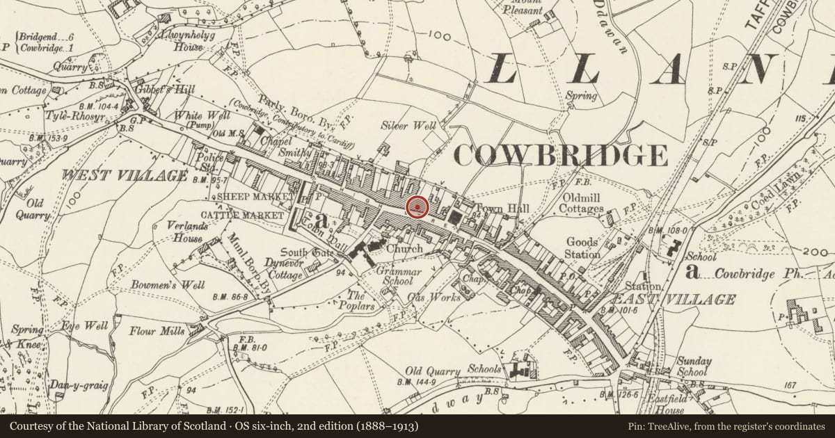
Slide toward Today to fade the historical sheet and see the modern map underneath.
David Rumsey Map Collection, Stanford LibrariesDavid Rumsey Map Collection, Stanford LibrariesDavid Rumsey Map Collection, Stanford LibrariesDavid Rumsey Map Collection, Stanford LibrariesDavid Rumsey Map Collection, Stanford Libraries
5 historical maps cover this location, the earliest the 1636 map "Cornubia : Devonia, Somersetus, Dorcestria, Wiltonia, Glocestria ..." (David Rumsey Map Collection, Stanford Libraries).
Historical maps covering this location
- 1636 · Cornubia : Devonia, Somersetus, Dorcestria, Wiltonia, Glocestria ... (David Rumsey Map Collection, Stanford Libraries)
- 1637 · The fourth table of England. Cornub. Devonia, Somerset etc. (David Rumsey Map Collection, Stanford Libraries)
- 1865 · England and Wales. England No. 6. (David Rumsey Map Collection, Stanford Libraries)
- 1897 · 262 Pontypridd (Hills) (David Rumsey Map Collection, Stanford Libraries)
- 1897 · 262 Pontypridd (Outline) (David Rumsey Map Collection, Stanford Libraries)
Cadw's description
Location
To right of Lloyds Bank.
History
C18 to early C19. Former pair of houses, now in several subdivisions.
Exterior
Two storey pair, now in several subdivisions, the front elevation with roughcast cladding and continuous slate gabled roof with red tile ridge; tall stone stack to left hand. Four first floor 12-pane sash windows with glazing bars. Two central pedimented doorways. On ground floor from right hand, firstly, plain modern roughcast arch with modern wrought-iron gate; secondly, modern shop front; thirdly, round-arched doorway to no 35b with reeded pilasters, pediment, plain reveals, plain fanlight and six-panelled door with top four panels reeded and fielded and bottom two reeded; knocker. Fourthly, round-arched doorway to no 35a with similar wooden doorcase but with blocked fanlight with tracery; similar six-panel door but with the top four panels forming one glazed panel. Fifthly, to left hand, modern shop front with hipped roof, central doorway.
Reason for designation
Late C18/early C19 pair whose surviving character includes good panelled doors within pedimented doorcases.
Nearby in the register
- XantippeCommercialunder 1 mi
- Lloyds BankCommercialunder 1 mi
- Lloyds ChemistCommercialunder 1 mi
- 31 High StreetCommercialunder 1 mi
Other entries of the same register within about three miles of this one, by straight line.