Cof Cymru: National Historic Assets of Wales · Wales
43 High Street
Cowbridge with Llanblethian, Vale of Glamorgan, Wales
A Grade II listed building in Cowbridge, Cowbridge with Llanblethian, Vale of Glamorgan, designated on 3 February 1981.
The record
- Designation
- Listed building, Grade II
- Broad class
- Commercial
- Date of designation
- 3 February 1981
- Locality
- Cowbridge
- Community
- Cowbridge with Llanblethian
- Unitary authority
- Vale of Glamorgan
- Country
- Wales
- Coordinates
- 51.46213, -3.44862
- Cadw reference
- 13208
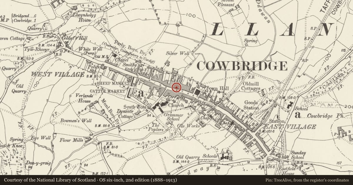
Slide toward Today to fade the historical sheet and see the modern map underneath.
David Rumsey Map Collection, Stanford LibrariesDavid Rumsey Map Collection, Stanford LibrariesDavid Rumsey Map Collection, Stanford LibrariesDavid Rumsey Map Collection, Stanford LibrariesDavid Rumsey Map Collection, Stanford Libraries
5 historical maps cover this location, the earliest the 1636 map "Cornubia : Devonia, Somersetus, Dorcestria, Wiltonia, Glocestria ..." (David Rumsey Map Collection, Stanford Libraries).
Historical maps covering this location
- 1636 · Cornubia : Devonia, Somersetus, Dorcestria, Wiltonia, Glocestria ... (David Rumsey Map Collection, Stanford Libraries)
- 1637 · The fourth table of England. Cornub. Devonia, Somerset etc. (David Rumsey Map Collection, Stanford Libraries)
- 1865 · England and Wales. England No. 6. (David Rumsey Map Collection, Stanford Libraries)
- 1897 · 262 Pontypridd (Hills) (David Rumsey Map Collection, Stanford Libraries)
- 1897 · 262 Pontypridd (Outline) (David Rumsey Map Collection, Stanford Libraries)
Cadw's description
Location
About 100m W of Town Hall.
History
C17 origin.
Exterior
Gable end of two storeys and attic, 1 bay to street. Roughcast cladding, with stuccoed apex; plain bargeboard and terracotta finial to gable end. Slate roof with cresting; several stacks. On ground floor, shop front with stall riser incorporating fragments of late C19 shop front; house doorway to left hand with fascia on scroll consoles. On first floor, canted three-light bay window with sash lights with glazing bars. On second floor, found-headed window.
Interior
Inside, massive partly cased ceiling beams to ground floor. On first floor, front room with C18 style fireplace which has pulvinated band, dentil cornice and acanthus moulding to architrave frame.
Reason for designation
C17 building retaining much character. Group value with adjacent listed buildings.
Nearby in the register
- Lloyds ChemistCommercialunder 1 mi
- XantippeCommercialunder 1 mi
- Etcetera and ThreshersCommercialunder 1 mi
- Nos. 35, 35a & 35b High StreetCommercialunder 1 mi
Other entries of the same register within about three miles of this one, by straight line.