Cof Cymru: National Historic Assets of Wales · Wales
Bryn Coed
Newport, Pembrokeshire, Wales
A Grade II listed building in Newport, Pembrokeshire, designated on 14 April 1992.
The record
- Designation
- Listed building, Grade II
- Broad class
- Domestic
- Date of designation
- 14 April 1992
- Community
- Newport
- Unitary authority
- Pembrokeshire
- Country
- Wales
- Coordinates
- 52.01594, -4.83287
- Cadw reference
- 12499
Slide toward Today to fade the historical sheet and see the modern map underneath.
David Rumsey Map Collection, Stanford LibrariesDavid Rumsey Map Collection, Stanford LibrariesDavid Rumsey Map Collection, Stanford LibrariesDavid Rumsey Map Collection, Stanford LibrariesDavid Rumsey Map Collection, Stanford Libraries
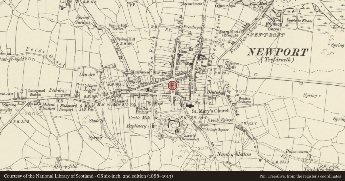
5 historical maps cover this location, the earliest the 1608 map "(13) Cambriae Typus." (David Rumsey Map Collection, Stanford Libraries).
Historical maps covering this location
- 1608 · (13) Cambriae Typus. (David Rumsey Map Collection, Stanford Libraries)
- 1891 · Sheet 10. Ordnance Survey of England and Wales. . (David Rumsey Map Collection, Stanford Libraries)
- 1898 · 210 Cardigan (Hills) (David Rumsey Map Collection, Stanford Libraries)
- 1898 · 210 Cardigan (Outline) (David Rumsey Map Collection, Stanford Libraries)
- 1901 · Sheet 13. (David Rumsey Map Collection, Stanford Libraries)
Cadw's description
Location
Situated in terraced row, the third building from N end.
Exterior
Early C19 house, stucco fronted with bitumen-covered slate roof and stone end stacks, shared with adjoining houses. Two and a half storey, 3-window range. Three gabled and bargeboarded eaves dormers with casement pairs,
3-first-floor later C19 margin-glazed sashes with raised stucco labels and painted slate sills; ground floor with 2 fine early C19 tripartite 4-12-4-pane bow windows each side of door in timber pedimented doorcase. Half glazed door with blocked overlight, reeded doorcase with shallow pediment. Bows have reeded piers, curved fascia and cornice. Stuccoed curved bases.
Front garden enclosed by dwarf slate wall with intersected hoop railings and gate.
Rear has hipped stair tower with round arched stair light, small-paned with intersected tracery to head. 20-pane sash below. Gabled 2-storey SW rear wing.
Nearby in the register
- Melrose (D.B.Davies, Pharmacy)Commercialunder 1 mi
- FronlasDomesticunder 1 mi
- The Llwyngwair ArmsCommercialunder 1 mi
- The Sessions HouseCommercialunder 1 mi
Other entries of the same register within about three miles of this one, by straight line.