Historic Buildings Record · Northern Ireland
17 Riverside
Town Parks, Antrim and Newtownabbey, Northern Ireland
The record
- Designation
- Record only (not listed)
- Grade
- Record Only
- Type
- House
- Date of construction
- 1840 - 1859
- Address
- 17 Riverside, Antrim, BT41 4BH
- Townland
- Town Parks
- Council
- Antrim and Newtownabbey
- Country
- Northern Ireland
- Coordinates
- 54.71267, -6.21718
- Date of survey
- 06 November 2004
- HB reference
- HB20/08/032
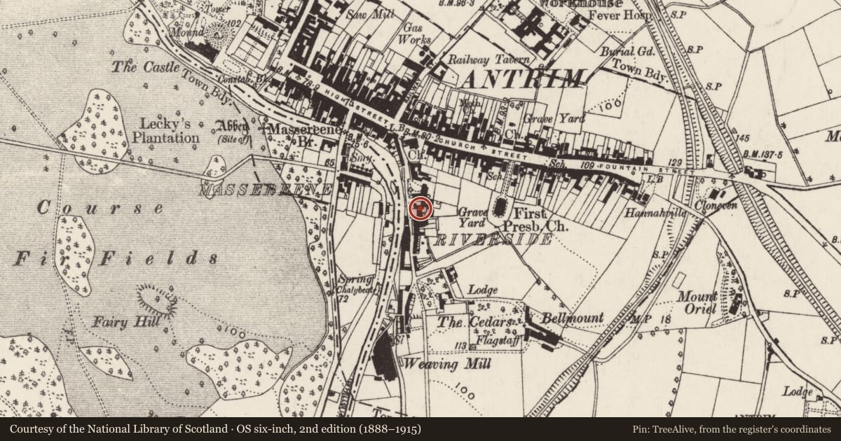
Slide toward Today to fade the historical sheet and see the modern map underneath.
David Rumsey Map Collection, Stanford LibrariesDavid Rumsey Map Collection, Stanford LibrariesDavid Rumsey Map Collection, Stanford LibrariesDavid Rumsey Map Collection, Stanford Libraries
4 historical maps cover this location, the earliest the 1838 map "Ireland, north sheet." (David Rumsey Map Collection, Stanford Libraries).
Historical maps covering this location
- 1838 · Ireland, north sheet. (David Rumsey Map Collection, Stanford Libraries)
- 1841 · Ireland. (David Rumsey Map Collection, Stanford Libraries)
- 1841 · Scotland (Southern part). XIII (David Rumsey Map Collection, Stanford Libraries)
The Department's description
Exterior description and setting
A five-bay, two-storey gabled house with pebble-dashed walls, smooth rendered dressings; slated roof which contains five modern gabled dormers, tongued and grooved sheeted to the front. PVC rainwater goods. Gabled end elevations and rear elevation are pebble dashed.
SETTING: Tarmac drive to one side; concrete surfaced car park to front; new three-storey apartment block currently being erected behind to rear.
Historical information
Precise date of building not recorded but it appears on the OS map of 1857 and may be dated to the mid-19th century.
References – Primary Sources
1. OS Map 1857, Co Antrim 50.
Secondary Sources
1. UAHS, Antrim and Ballymena (Belfast, 1969), p 10.
Criteria for listing: architectural interest
Not listed
Criteria for listing: historic interest
Not listed
Evaluation
This is a mid-19th century building which has undergone a number of inappropriate alterations and is of little special architectural or historic interest.
Nearby in the register
- 18 RiversideHouse - Terraceunder 1 mi
- 20 RiversideHouse - Terraceunder 1 mi
- 22 RiversideHouse - Terraceunder 1 mi
- 19-27 RiversideHouseunder 1 mi
Other entries of the same register within about three miles of this one, by straight line.