Historic Buildings Record · Northern Ireland
War Memorial
Glynn, Mid and East Antrim, Northern Ireland
The record
- Designation
- Record only (not listed)
- Grade
- Record Only
- Type
- Memorial
- Date of construction
- 1920 - 1939
- Address
- War Memorial, Main Road, Glynn, Larne, Co Antrim
- Townland
- Glynn
- Council
- Mid and East Antrim
- Country
- Northern Ireland
- Coordinates
- 54.82769, -5.81113
- Date of survey
- 05 September 1997
- HB reference
- HB06/06/008
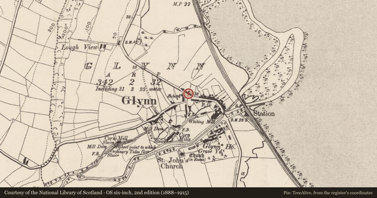
Slide toward Today to fade the historical sheet and see the modern map underneath.
David Rumsey Map Collection, Stanford LibrariesDavid Rumsey Map Collection, Stanford LibrariesDavid Rumsey Map Collection, Stanford Libraries
3 historical maps cover this location, the earliest the 1900 map "Ireland" (David Rumsey Map Collection, Stanford Libraries).
Historical maps covering this location
- 1900 · Ireland (David Rumsey Map Collection, Stanford Libraries)
- 1906 · Edinburgh. Scottish Lake District. Index Map: Ireland. (David Rumsey Map Collection, Stanford Libraries)
- 1922 · Scotland - southern section. (David Rumsey Map Collection, Stanford Libraries)
The Department's description
Exterior description and setting
A war memorial in the form of an obelisk surmounting a high square pedestral and stepped base, surrounded by a low plinth wall, all constructed of dressed granite. It stands in the middle of the village at the centre of a road junction.
Historical information
Erected as a memorial to the men of Glynn, Magheramorne and Raloo who died in the 1st World War.
References - Primary
1. Inscription on memorial
Criteria for listing: architectural interest
Not listed
Criteria for listing: historic interest
Not listed
Evaluation
This is a memorial of local interest which forms a landmark in the village, but is of little architectural interest.
Nearby in the register
- 22 Main RoadHouseunder 1 mi
- Glynn Village HallHallunder 1 mi
- Glynn Primary SchoolSchoolunder 1 mi
- Bridge at GlynnBridgeunder 1 mi
Other entries of the same register within about three miles of this one, by straight line.