Sites and Monuments Record · Ireland
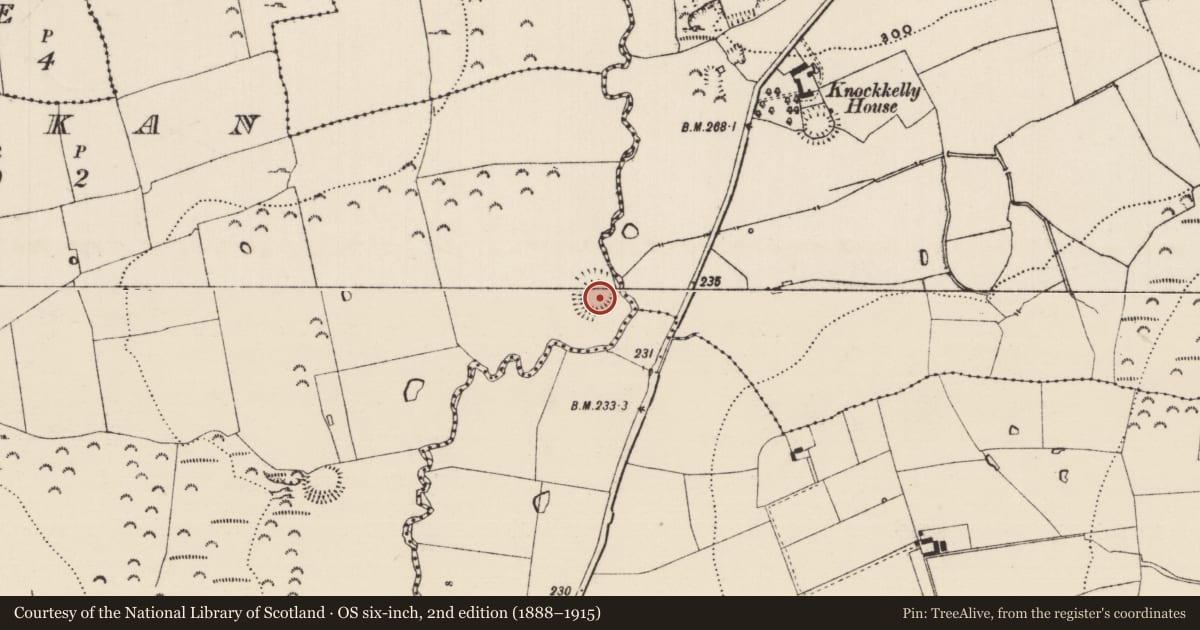
Enclosure
Kilknockan, County Tipperary South, Ireland
The record
- Townland
- Kilknockan
- County
- Tipperary South
- Country
- Ireland
- First-edition OS map
- Hachured
- Latest-edition OS map
- Hachured
- Coordinates
- 52.48634, -7.67349
- SMR number
- TS070-013----
Slide toward Today to fade the historical sheet and see the modern map underneath.
David Rumsey Map Collection, Stanford LibrariesDavid Rumsey Map Collection, Stanford LibrariesDavid Rumsey Map Collection, Stanford LibrariesDavid Rumsey Map Collection, Stanford Libraries
4 historical maps cover this location, the earliest the 1790 map "Composite: Ireland." (David Rumsey Map Collection, Stanford Libraries).
Historical maps covering this location
- 1790 · Composite: Ireland. (David Rumsey Map Collection, Stanford Libraries)
- 1882 · Ireland (southern half). (David Rumsey Map Collection, Stanford Libraries)
- 1891 · Ireland 16 (David Rumsey Map Collection, Stanford Libraries)
- 1904 · Sheet 13. (David Rumsey Map Collection, Stanford Libraries)
This record in the National Monuments Service's Historic Environment Viewer ↗
The National Monuments Service's description
On fairly level ground in pasture with Clashawley river flowing roughly N-S c. 30m SE of monument. Roughly circular ringfort (diam. 45m N-S; 43m E-W) enclosed by a bank (Wth 3.1-4m; int. H 0.33-0.58m; ext. H 0.5m-1.06m) composed of gravelly clay. No visible trace of an external fosse. Bank is quite disturbed, particularly in SE quadrant. Soil dumped in interior against bank in E quadrant. Bank is overgrown with brambles from NE-E-SE and is surmounted by hedgerow from SW-W-NE. Gap in S sector (Wth 5m) utilised by machinery to gain access to interior. Trees, c. 10-15 years old, are growing in the W half of the interior with some conifers in the NE quadrant. Enclosure is adjacent to a horse burial ground and three horse graves (dims. 1.7m x 3.8m; D 1.1m; 1.8m x 3.4m; D 0.6m; 1.8m x 1.3m; D 0.2m) have been dug in the interior in the N and NW quadrant, these were open at time of inspection with the upcast placed to one side.
Compiled by: Jean Farrelly
Date of upload: 26 August 2011
Nearby in the register
Other entries of the same register within about three miles of this one, by straight line.