Sites and Monuments Record · Ireland
Graveyard
Freshford Lots, County Kilkenny, Ireland
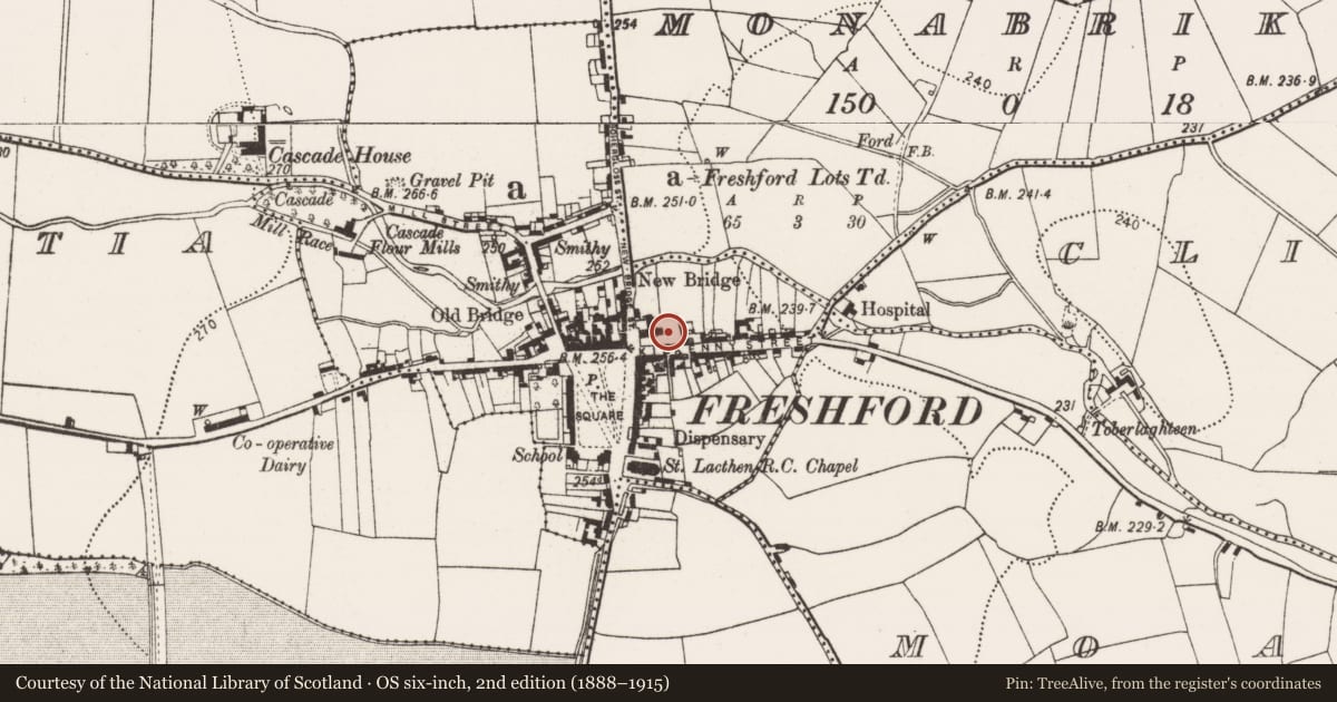
The record
- Townland
- Freshford Lots
- County
- Kilkenny
- Country
- Ireland
- First-edition OS map
- Indicated
- Latest-edition OS map
- Indicated
- Coordinates
- 52.73275, -7.39750
- SMR number
- KK013-023002-
Slide toward Today to fade the historical sheet and see the modern map underneath.
David Rumsey Map Collection, Stanford LibrariesDavid Rumsey Map Collection, Stanford LibrariesDavid Rumsey Map Collection, Stanford LibrariesDavid Rumsey Map Collection, Stanford Libraries
4 historical maps cover this location, the earliest the 1790 map "Composite: Ireland." (David Rumsey Map Collection, Stanford Libraries).
Historical maps covering this location
- 1790 · Composite: Ireland. (David Rumsey Map Collection, Stanford Libraries)
- 1811 · Ireland. (David Rumsey Map Collection, Stanford Libraries)
- 1869 · Ireland. (David Rumsey Map Collection, Stanford Libraries)
- 1891 · Ireland 16 (David Rumsey Map Collection, Stanford Libraries)
This record in the National Monuments Service's Historic Environment Viewer ↗
The National Monuments Service's description
A rectangular graveyard (dims. c. 37m N-S; c. 55m E-W), defined by a stone wall, which extends N, E and S of a Romanesque church (KK013-023001-) with later additions, including a 19th-century annexe which runs N-S across the N portion of the graveyard, separating the NW quadrant from the rest of the graveyard. The church and graveyard are roughly centrally placed in Freshford, at the junction of Kilkenny Street to the S and New Bridge Street to the W. The graveyard is entered through a gate in the W wall. According to Carrigan (1905, vol. 2, 255) the graveyard was, 'thickly-tenanted', with 'many monuments dating from about 1730 onwards'. He noted on recumbent graveslab dating to the 17th century (KK013-023003-) and a late medieval graveslab fragment (KK013-023010-) inserted in the W graveyard wall beside the entrance gate (ibid.). There is also a 17th-century graveslab (KK013-023012-) in the W graveyard wall and a 13th/14th century graveslab (KK013-023013-) in the SE portion of the graveyard.
Compiled by: Jean Farrelly
Date of upload: 21 April 2020
References
Carrigan, Rev. W. 1905 (Reprint 1981) The history and antiquities of the diocese of Ossory, 4 vols. Kilkenny. Roberts Books and Wellbrook Press.
Nearby in the register
Other entries of the same register within about three miles of this one, by straight line.