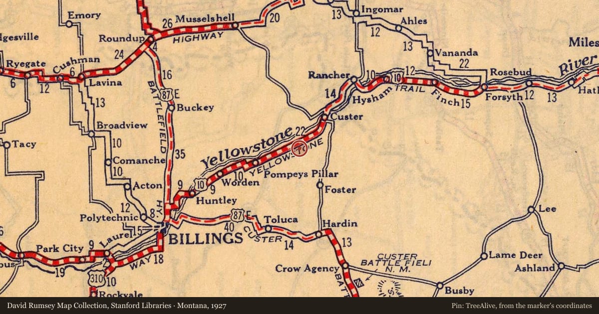
Motoring was an adventure in the second decade of the 20th century and people usually didn’t travel very far from home. There were few paved roads, most were choked with dust during the summers, knee-deep in mud in the rainy seasons, and blocked by snowdrifts in the winters. But as more people bought cars, they demanded better roads. Some banded together and formed organizations dedicated to the construction of good roads, which, they believed, increased commerce and made for prosperous communities. One way to prosperity was through tourism. Tourists stayed in local hotels or auto camps, ate at local restaurants, and spent money. For many communities, like Custer, a good road was just as important as the railroad.
In 1912, businessmen from South Dakota, Minnesota, and Montana formed an organization dedicated to establishing a good coast-to-coast road. Called the Yellowstone Trail, the road ultimately evolved into a coast-to-coast highway connecting Plymouth Rock, Massachusetts and Seattle, Washington with a branch from Livingston south to Yellowstone National Park. The trail was an interconnected chain of county roads marked by chrome yellow signs with arrows pointing the way. Members of the Yellowstone Trail Association (YTA) aggressively promoted the road to tourists and sponsored annual “Trail Days” where local citizens kept the road in passable condition. The YTA designated local businessmen along the route as “Trail men,” who offered a helping hand to travelers on the road.
The Yellowstone Trail in Montana was 800 miles long, including roads that branched off the main route to Yellowstone Park and other important tourist destinations. Initially a dirt road that was “slippery in wet weather,” the Montana Highway Department began to slowly make improvements to it after World War I. By 1926, the Yellowstone Trail was officially known as US Highway 10.. Montana spent more money on road improvements to the Yellowstone Trail than any other state along its route. Today, Interstates 94 and 90 parallel much of the old Yellowstone Trail.
Slide toward Today to fade the historical sheet and see the modern map underneath.
For example, one family's tree showed the Articles of Confederation marker in Pennsylvania standing under a mile from where William Gabby lived in the 1760s.
What that marker records spans 1777 to 1789, overlapping William Gabby's years there.