Cof Cymru: National Historic Assets of Wales · Wales
Landshipping House Garden Remains
Martletwy, Pembrokeshire, Wales
A scheduled monument in Martletwy, Pembrokeshire, recorded as Garden (Post Medieval/Modern).
The record
- Designation
- Scheduled monument
- Site type
- Garden
- Period
- Post Medieval/Modern
- Date of designation
- 27 April 1994
- Community
- Martletwy
- Unitary authority
- Pembrokeshire
- Country
- Wales
- Coordinates (centre of the scheduled area)
- 51.76313, -4.86952
- SAM number
- PE454
- Cadw record number
- 3288
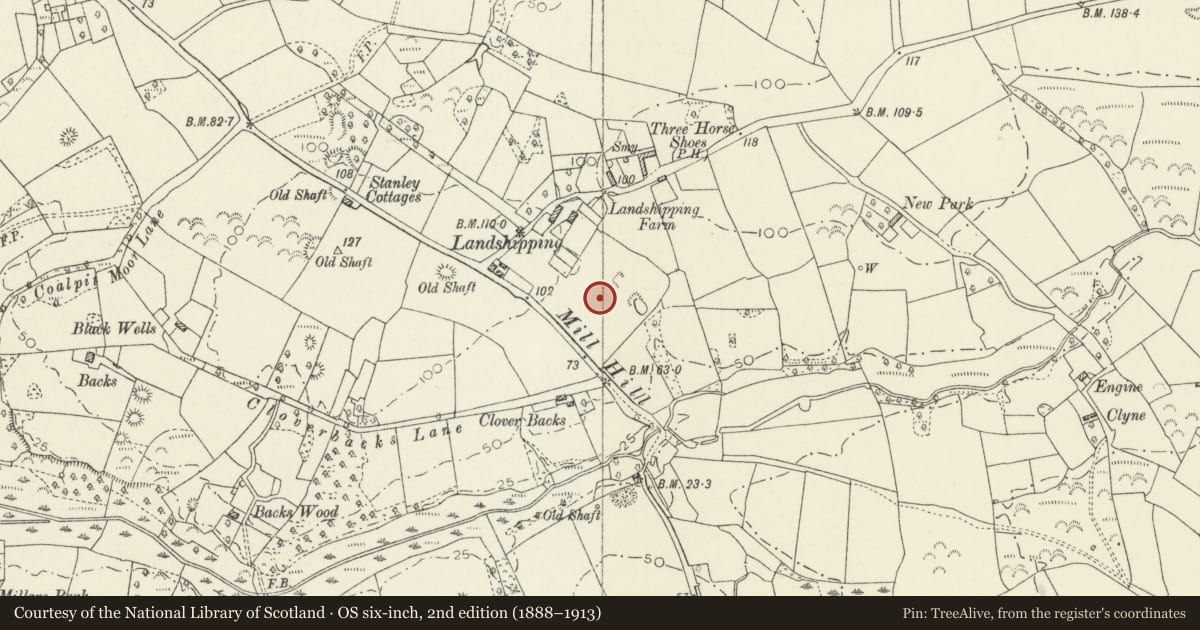
Slide toward Today to fade the historical sheet and see the modern map underneath.
David Rumsey Map Collection, Stanford LibrariesDavid Rumsey Map Collection, Stanford LibrariesDavid Rumsey Map Collection, Stanford LibrariesDavid Rumsey Map Collection, Stanford LibrariesBayerische Staatsbibliothek, Munich
5 historical maps cover this location, the earliest the 1588 map "Ortelius, Abraham: Theatro De La Tierra Universal. 0" (Bayerische Staatsbibliothek, Munich).
Historical maps covering this location
- 1588 · Ortelius, Abraham: Theatro De La Tierra Universal. 0 (Bayerische Staatsbibliothek, Munich)
- 1608 · (13) Cambriae Typus. (David Rumsey Map Collection, Stanford Libraries)
- 1891 · Sheet 10. Ordnance Survey of England and Wales. . (David Rumsey Map Collection, Stanford Libraries)
- 1898 · 228 Haverfordwest (Hills) (David Rumsey Map Collection, Stanford Libraries)
- 1901 · Sheet 13. (David Rumsey Map Collection, Stanford Libraries)
Cadw's description
Summary description and reason for designation
The following provides a general description of the Scheduled Ancient Monument.
The monument consists of a garden associated with the now-demolished Landshipping House. Documentary evidence records work on a water folly here in 1697, and the garden seems to have been created by Sir Arthur Owen, 3rd Bart. of Orileton, after he became an MP in 1695. Remains extend over 2.1 ha; the north end has two brick walled gardens, the earlier with walls up to 2.5 m high and windows over what was formerly the great garden, surrounded by a stone wall it is full of complex earthwork features relating to an elaborate formal garden within which are three formal ponds and a further two ponds to the south.
The monument is of national importance for its potential to enhance our knowledge of the use of gardens and parks. It retains significant archaeological potential, with a strong probability of the presence of associated archaeological features and deposits.
The scheduled area comprises the remains described and areas around them within which related evidence may be expected to survive.
Nearby in the register
- Church of St. MarcellusReligious, Ritual and Funeraryunder 1 mi
- Burnett's Hill Calvinistic Methodist ChapelReligious, Ritual and Funeraryunder 1 mi
- Castle Lake CampPromontory Fort - coastal1 mi
- Picton Point CampPromontory Fort - coastal1 mi
Other entries of the same register within about three miles of this one, by straight line.