Cof Cymru: National Historic Assets of Wales · Wales
Picton Point Camp
Slebech, Pembrokeshire, Wales
A scheduled monument in Slebech, Pembrokeshire, recorded as Promontory Fort - coastal (Prehistoric).
The record
- Designation
- Scheduled monument
- Site type
- Promontory Fort - coastal
- Period
- Prehistoric
- Community
- Slebech
- Unitary authority
- Pembrokeshire
- Country
- Wales
- Coordinates (centre of the scheduled area)
- 51.76860, -4.89577
- SAM number
- PE280
- Cadw record number
- 2050
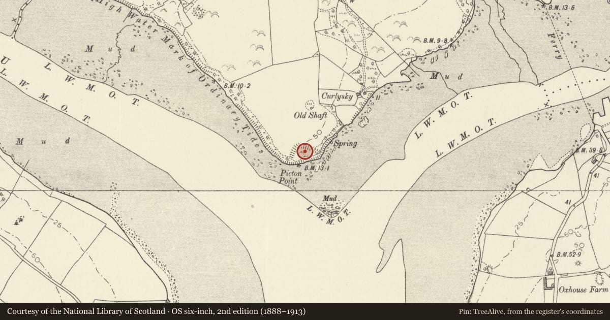
Slide toward Today to fade the historical sheet and see the modern map underneath.
David Rumsey Map Collection, Stanford LibrariesDavid Rumsey Map Collection, Stanford LibrariesDavid Rumsey Map Collection, Stanford LibrariesDavid Rumsey Map Collection, Stanford LibrariesDavid Rumsey Map Collection, Stanford Libraries
5 historical maps cover this location, the earliest the 1636 map "Cornubia : Devonia, Somersetus, Dorcestria, Wiltonia, Glocestria ..." (David Rumsey Map Collection, Stanford Libraries).
Historical maps covering this location
- 1636 · Cornubia : Devonia, Somersetus, Dorcestria, Wiltonia, Glocestria ... (David Rumsey Map Collection, Stanford Libraries)
- 1830 · V.3:11-15:XV. Britisches Reich. A. Kon: England. b. Frstenthum Wales: Shire: 37-40 (David Rumsey Map Collection, Stanford Libraries)
- 1891 · Sheet 10. Ordnance Survey of England and Wales. . (David Rumsey Map Collection, Stanford Libraries)
- 1898 · 228 Haverfordwest (Hills) (David Rumsey Map Collection, Stanford Libraries)
- 1901 · Sheet 13. (David Rumsey Map Collection, Stanford Libraries)
Cadw's description
Summary description and reason for designation
The following provides a general description of the Scheduled Ancient Monument.
The monument comprises the remains of a defended enclosure, which probably dates to the Iron Age period (c. 800 BC - AD 74, the Roman conquest of Wales)and which occupies a significant location set above the confluence of the east and west Cleddau rivers. A bank and traces of a ditch enclose a fairly level, roughly triangular shaped interior between rivers cliffs, the entrance may have been on the east.
The monument is of national importance for its potential to enhance our knowledge of later prehistoric defensive organisation and settlement. The site forms an important element within the wider later prehistoric context and within the surrounding landscape. The site is well preserved and retains considerable archaeological potential. There is a strong probability of the presence of evidence relating to chronology, building techniques and functional detail.
The scheduled area comprises the remains described and areas around them within which related evidence may be expected to survive.
Nearby in the register
- East HookDomesticunder 1 mi
- Ruined outbuilding at East HookDomesticunder 1 mi
- Bridge at Kennel WoodTransportunder 1 mi
- Walled Garden at Picton CastleDomestic1 mi
Other entries of the same register within about three miles of this one, by straight line.