Cof Cymru: National Historic Assets of Wales · Wales
Castle Lake Camp
Slebech, Pembrokeshire, Wales
A scheduled monument in Slebech, Pembrokeshire, recorded as Promontory Fort - coastal (Prehistoric).
The record
- Designation
- Scheduled monument
- Site type
- Promontory Fort - coastal
- Period
- Prehistoric
- Date of designation
- 17 June 1952
- Community
- Slebech
- Unitary authority
- Pembrokeshire
- Country
- Wales
- Coordinates (centre of the scheduled area)
- 51.78000, -4.86947
- SAM number
- PE278
- Cadw record number
- 2049
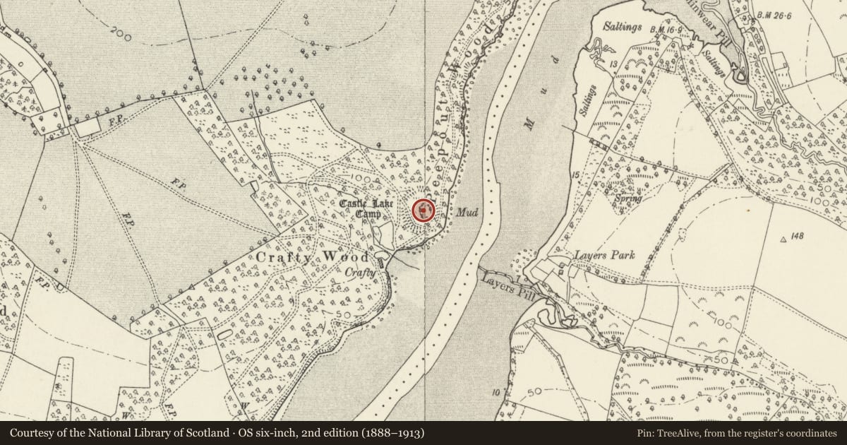
Slide toward Today to fade the historical sheet and see the modern map underneath.
David Rumsey Map Collection, Stanford LibrariesDavid Rumsey Map Collection, Stanford LibrariesDavid Rumsey Map Collection, Stanford LibrariesDavid Rumsey Map Collection, Stanford LibrariesDavid Rumsey Map Collection, Stanford Libraries
5 historical maps cover this location, the earliest the 1636 map "Cornubia : Devonia, Somersetus, Dorcestria, Wiltonia, Glocestria ..." (David Rumsey Map Collection, Stanford Libraries).
Historical maps covering this location
- 1636 · Cornubia : Devonia, Somersetus, Dorcestria, Wiltonia, Glocestria ... (David Rumsey Map Collection, Stanford Libraries)
- 1830 · V.3:11-15:XV. Britisches Reich. A. Kon: England. b. Frstenthum Wales: Shire: 37-40 (David Rumsey Map Collection, Stanford Libraries)
- 1891 · Sheet 10. Ordnance Survey of England and Wales. . (David Rumsey Map Collection, Stanford Libraries)
- 1898 · 228 Haverfordwest (Hills) (David Rumsey Map Collection, Stanford Libraries)
- 1901 · Sheet 13. (David Rumsey Map Collection, Stanford Libraries)
Cadw's description
Summary description and reason for designation
The summary description for this record is currently under review and a revised description is being drafted.
Nearby in the register
- Remains of Grotto in Garden of Picton CastleGardens, Parks and Urban Spacesunder 1 mi
- Picton Castle MoundMotteunder 1 mi
- Stables and Coach-house at Picton CastleDomesticunder 1 mi
- Raised Terrace at East Entrance to Picton CastleDomesticunder 1 mi
Other entries of the same register within about three miles of this one, by straight line.