Cof Cymru: National Historic Assets of Wales · Wales
Bwlch-y-Cibau Enclosure
Meifod, Powys, Wales
A scheduled monument in Meifod, Powys, recorded as Enclosure (Prehistoric).
The record
- Designation
- Scheduled monument
- Site type
- Enclosure
- Period
- Prehistoric
- Date of designation
- 10 October 1988
- Community
- Meifod
- Unitary authority
- Powys
- Country
- Wales
- Coordinates (centre of the scheduled area)
- 52.74770, -3.22160
- SAM number
- MG210
- Cadw record number
- 3012
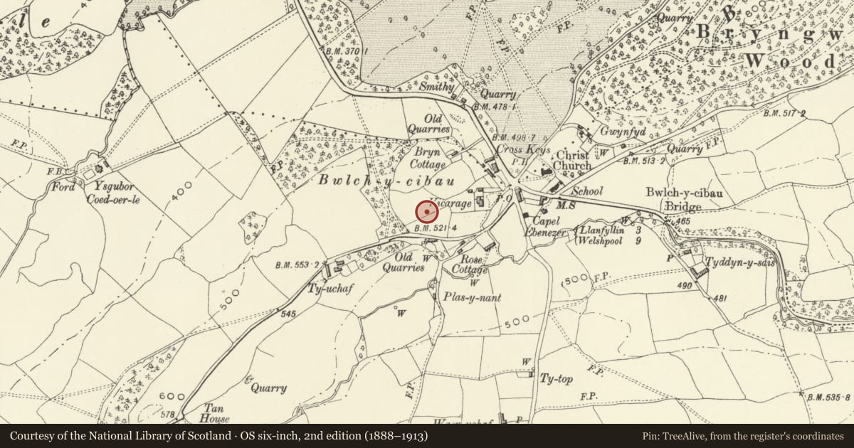
Slide toward Today to fade the historical sheet and see the modern map underneath.
David Rumsey Map Collection, Stanford LibrariesDavid Rumsey Map Collection, Stanford LibrariesDavid Rumsey Map Collection, Stanford LibrariesDavid Rumsey Map Collection, Stanford LibrariesLlyfrgell Genedlaethol Cymru – The National Library of Wales
5 historical maps cover this location, the earliest the 1795 map "To Sir Watkin Williams-Wynn Bart ... the map of the six counties of North Wales is most humbly inscribed by his obedient humble servant" (Llyfrgell Genedlaethol Cymru – The National Library of Wales).
Historical maps covering this location
- 1795 · To Sir Watkin Williams-Wynn Bart ... the map of the six counties of North Wales is most… (Llyfrgell Genedlaethol Cymru – The National Library of Wales)
- 1883 · Watershed map England, Wales 3. (David Rumsey Map Collection, Stanford Libraries)
- 1897 · 137 Oswestry (Hills) (David Rumsey Map Collection, Stanford Libraries)
- 1901 · Sheet 9 and 10. (David Rumsey Map Collection, Stanford Libraries)
- 1916 · Sheet 60. Shrewsbury. (David Rumsey Map Collection, Stanford Libraries)
Cadw's description
Summary description and reason for designation
The following provides a general description of the scheduled monument.
The monument comprises the remains of an earthwork/stone-built enclosure. The date or precise nature of the enclosure is unknown, but it is likely to be later prehistoric. The enclosure is an oval univallate enclosure, c. 80m E-W x 45m N-S internally, situated on top of a steep scarp (to S), a rampart survives clearly only on the southern arc. A slight counterscarp ditch survives on the N side. There are no visible internal features and the ground has been improved in the past. Nevertheless preservation appears to be good and the size is a good example of a minor defensive prehistoric enclosure.
The monument is of national importance for its potential to enhance our knowledge of later prehistoric defensive organisation and settlement. The site forms an important element within the wider later prehistoric context and within the surrounding landscape. The site is well preserved and retains considerable archaeological potential. There is a strong probability of the presence of evidence relating to chronology, building techniques and functional detail.
The scheduled area comprises the remains described and areas around them within which related evidence may be expected to survive.
Nearby in the register
- Drinking FountainGardens, Parks and Urban Spacesunder 1 mi
- Lych-Gate to Christ Church Parish ChurchReligious, Ritual and Funeraryunder 1 mi
- Sundial in the Churchyard to Christ Church Parish ChurchGardens, Parks and Urban Spacesunder 1 mi
- Christ Church Parish ChurchReligious, Ritual and Funeraryunder 1 mi
Other entries of the same register within about three miles of this one, by straight line.