Cof Cymru: National Historic Assets of Wales · Wales
Drinking Fountain
Meifod, Powys, Wales
A Grade II listed building in Bwlch-y-Cibau, Meifod, Powys, designated on 26 May 1995.
The record
- Designation
- Listed building, Grade II
- Broad class
- Gardens, Parks and Urban Spaces
- Date of designation
- 26 May 1995
- Locality
- Bwlch-y-Cibau
- Community
- Meifod
- Unitary authority
- Powys
- Country
- Wales
- Coordinates
- 52.74834, -3.21887
- Cadw reference
- 15960
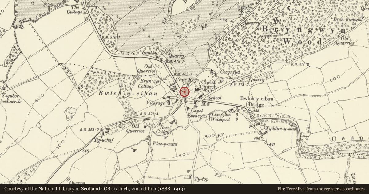
Slide toward Today to fade the historical sheet and see the modern map underneath.
David Rumsey Map Collection, Stanford LibrariesDavid Rumsey Map Collection, Stanford LibrariesDavid Rumsey Map Collection, Stanford LibrariesDavid Rumsey Map Collection, Stanford LibrariesLlyfrgell Genedlaethol Cymru – The National Library of Wales
5 historical maps cover this location, the earliest the 1795 map "To Sir Watkin Williams-Wynn Bart ... the map of the six counties of North Wales is most humbly inscribed by his obedient humble servant" (Llyfrgell Genedlaethol Cymru – The National Library of Wales).
Historical maps covering this location
- 1795 · To Sir Watkin Williams-Wynn Bart ... the map of the six counties of North Wales is most… (Llyfrgell Genedlaethol Cymru – The National Library of Wales)
- 1883 · Watershed map England, Wales 3. (David Rumsey Map Collection, Stanford Libraries)
- 1897 · 137 Oswestry (Hills) (David Rumsey Map Collection, Stanford Libraries)
- 1901 · Sheet 9 and 10. (David Rumsey Map Collection, Stanford Libraries)
- 1916 · Sheet 60. Shrewsbury. (David Rumsey Map Collection, Stanford Libraries)
Cadw's description
Location
Located on the grass verge opposite the Lych Gate of Christ Church parish church.
Exterior
Public drinking fountain, c.1895. Ashlar limestone, in the form of a wall with offsetting ends rising to gabled copings, the central section of which rises a further course and similarly coped but adorned with a triangular gablet. At the centre a 2-centred chamfered arched recess containing the water source piped through from the back, running into a cantilevered semi-circular bowl finely decorated with fin-de-si_cle leaves, and an inscription around the rim reading INòREMEMBRANCEò MAE---R WILLIAMSòBRYNGWYN. A panel over the arch is ambiguously inscribed WHOSOEVER DRINKETH:OF:THIS: / WATER:SHALL:THIRST:AGAIN: / BUT:WHOSOEVER:DRINKETH:THE: / WATER:THAT:I:SHALL:GIVE:HIM / SHALL:NEVER:THIRST.
Reason for designation
Included as a handsome public monument, of group value with the lych-gate and Christ Church parish church.
Nearby in the register
- Lych-Gate to Christ Church Parish ChurchReligious, Ritual and Funeraryunder 1 mi
- Sundial in the Churchyard to Christ Church Parish ChurchGardens, Parks and Urban Spacesunder 1 mi
- Christ Church Parish ChurchReligious, Ritual and Funeraryunder 1 mi
- Bwlch-y-Cibau EnclosureEnclosureunder 1 mi
Other entries of the same register within about three miles of this one, by straight line.