Cof Cymru: National Historic Assets of Wales · Wales
Castell Caergwrle
Hope, Flintshire, Wales
A scheduled monument in Hope, Flintshire, recorded as Castle (Medieval).
The record
- Designation
- Scheduled monument
- Site type
- Castle
- Period
- Medieval
- Community
- Hope
- Unitary authority
- Flintshire
- Country
- Wales
- Coordinates (centre of the scheduled area)
- 53.10749, -3.03663
- SAM number
- FL020
- Cadw record number
- 3086
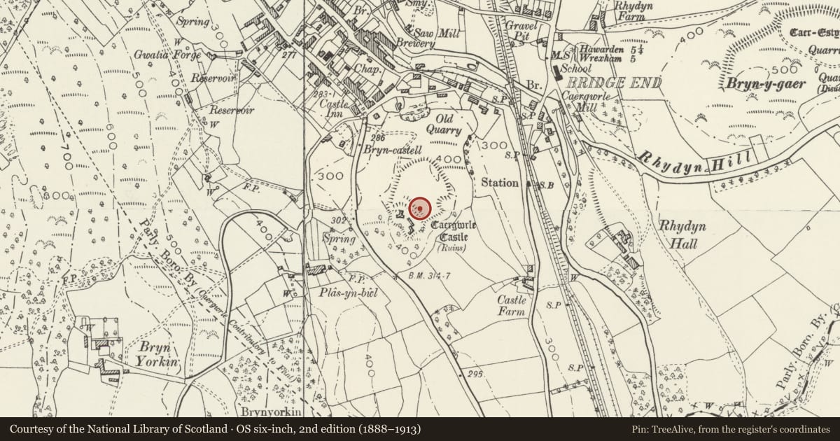
Slide toward Today to fade the historical sheet and see the modern map underneath.
David Rumsey Map Collection, Stanford LibrariesDavid Rumsey Map Collection, Stanford LibrariesDavid Rumsey Map Collection, Stanford LibrariesLlyfrgell Genedlaethol Cymru – The National Library of WalesDavid Rumsey Map Collection, Stanford Libraries
5 historical maps cover this location, the earliest the 1608 map "(13) Cambriae Typus." (David Rumsey Map Collection, Stanford Libraries).
Historical maps covering this location
- 1608 · (13) Cambriae Typus. (David Rumsey Map Collection, Stanford Libraries)
- 1795 · To Sir Watkin Williams-Wynn Bart ... the map of the six counties of North Wales is most… (Llyfrgell Genedlaethol Cymru – The National Library of Wales)
- 1883 · Watershed map England, Wales 3. (David Rumsey Map Collection, Stanford Libraries)
- 1898 · 108 Flint (Hills) (David Rumsey Map Collection, Stanford Libraries)
- 1901 · Sheet 9 and 10. (David Rumsey Map Collection, Stanford Libraries)
Cadw's description
Summary description and reason for designation
The monument consists of the remains of a castle, dating to the medieval period. A castle is a defended residence or stronghold, built mainly of stone, in which the principal or sole defence comprises the walls and towers bounding the site. Some form of keep may have stood within the enclosure but these were not significant in defensive terms and served mainly to provide accommodation.
Caergwrle Castle was erected by Dafydd ap Gruffydd in about 1278, and was thus the last native Welsh stone built castle. The castle was then held and refurbished by Edward I (1282). The castle is defended on the north and east sides by a rock-cut ditch and counterscarp bank. The castle was destroyed by fire on 27th August 1282. The remains of the late thirteenth century masonry castle are set at the south-south-west angle of an irregular enclosure defining the relatively level summit of a steep-sided hill. Excavation demonstrated that this enclosure, roughly 110m north-west to south-east by 120m, had been defined by a stone-revetted wall, radio-carbon dating indicating an early medieval date.
The monument is of national importance for its potential to enhance our knowledge of medieval defensive practices. The monument is well-preserved and an important relic of the medieval landscape. It retains significant archaeological potential, with a strong probability of the presence of both structural evidence and intact associated deposits.
The scheduled area comprises the remains described and areas around them within which related evidence may be expected to survive.
Nearby in the register
- Caergwrle CastleDefenceunder 1 mi
- Plas-yn-BwlDomesticunder 1 mi
- Bridge End BridgeTransportunder 1 mi
- Castellated Gateway and Walls at Rhydyn HallGardens, Parks and Urban Spacesunder 1 mi
Other entries of the same register within about three miles of this one, by straight line.