Cof Cymru: National Historic Assets of Wales · Wales
Penllwyn
Llandysiliogogo, Ceredigion, Wales
A Grade II listed building in Nanternis, Llandysiliogogo, Ceredigion, designated on 3 June 1964.
The record
- Designation
- Listed building, Grade II
- Broad class
- Domestic
- Date of designation
- 3 June 1964
- Locality
- Nanternis
- Community
- Llandysiliogogo
- Unitary authority
- Ceredigion
- Country
- Wales
- Coordinates
- 52.18488, -4.39316
- Cadw reference
- 9806
Slide toward Today to fade the historical sheet and see the modern map underneath.
David Rumsey Map Collection, Stanford LibrariesDavid Rumsey Map Collection, Stanford LibrariesDavid Rumsey Map Collection, Stanford LibrariesDavid Rumsey Map Collection, Stanford LibrariesDavid Rumsey Map Collection, Stanford Libraries
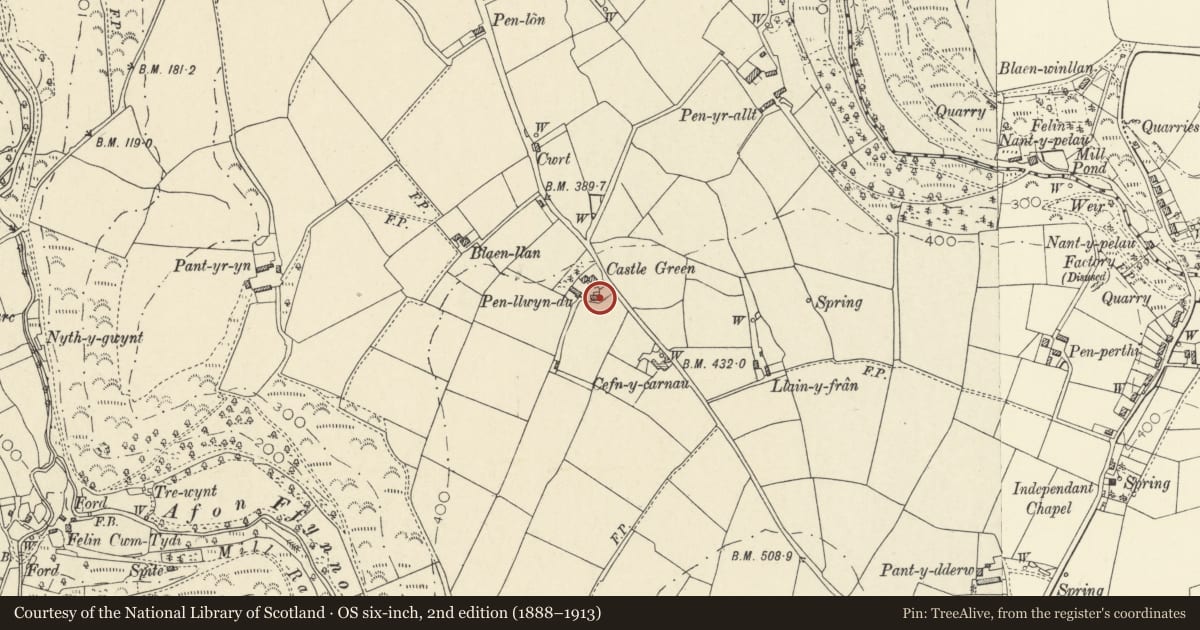
5 historical maps cover this location, the earliest the 1608 map "(13) Cambriae Typus." (David Rumsey Map Collection, Stanford Libraries).
Historical maps covering this location
- 1608 · (13) Cambriae Typus. (David Rumsey Map Collection, Stanford Libraries)
- 1830 · V.3:11-15:XV. Britisches Reich. A. Kon: England. b. Frstenthum Wales: Shire: 37-40 (David Rumsey Map Collection, Stanford Libraries)
- 1899 · 194 Llangranog (Hills) (David Rumsey Map Collection, Stanford Libraries)
- 1901 · Sheet 14. (David Rumsey Map Collection, Stanford Libraries)
- 1919 · Sheet 78. Lampeter. (David Rumsey Map Collection, Stanford Libraries)
Cadw's description
Location
Situated on W side of by-road, 1.3km NW of Nanternis. Reached along short drive.
History
Early C19 farmhouse. Shown on 1845 Tithe map, when the owner was Elizabeth Jones and the farm 26 acres in extent.
Exterior
White painted rubble construction. Slate roof with timber eaves and bargeboards. Rubble gable chimney-stacks, thicker to left; drip to right chimney. Two storey 3-bay front offset to right. Small upper 6/3-pane hornless sash windows with cambered stone voussoired heads. Twelve-pane hornless sash to ground floor left, later 4-pane horned sash to right: heads as above. Slate sills. C20 central door with lintel.
Later single storey 2-bay extension to right; similar construction to house. Boarded stable-type door to left and small C20 window to right.
Rubble forecourt wall, late C19 cast iron gate to centre with square stone piers.
Interior
The interior was unavailable for inspection.
Reason for designation
Early C19 farmhouse with good regional character.
Nearby in the register
- Castle GreenDomesticunder 1 mi
- Church of St. TysilioReligious, Ritual and Funeraryunder 1 mi
- Forecourt walls, rails and gates at Nanternis Independent ChapelReligious, Ritual and Funeraryunder 1 mi
- Nanternis Independent ChapelReligious, Ritual and Funeraryunder 1 mi
Other entries of the same register within about three miles of this one, by straight line.