Cof Cymru: National Historic Assets of Wales · Wales
Forecourt walls, rails and gates at Nanternis Independent Chapel
Llandysiliogogo, Ceredigion, Wales
A Grade II listed building in Nanternis, Llandysiliogogo, Ceredigion, designated on 2 February 1996.
The record
- Designation
- Listed building, Grade II
- Broad class
- Religious, Ritual and Funerary
- Date of designation
- 2 February 1996
- Locality
- Nanternis
- Community
- Llandysiliogogo
- Unitary authority
- Ceredigion
- Country
- Wales
- Coordinates
- 52.18245, -4.38227
- Cadw reference
- 16632
Slide toward Today to fade the historical sheet and see the modern map underneath.
David Rumsey Map Collection, Stanford LibrariesDavid Rumsey Map Collection, Stanford LibrariesDavid Rumsey Map Collection, Stanford LibrariesDavid Rumsey Map Collection, Stanford LibrariesDavid Rumsey Map Collection, Stanford Libraries
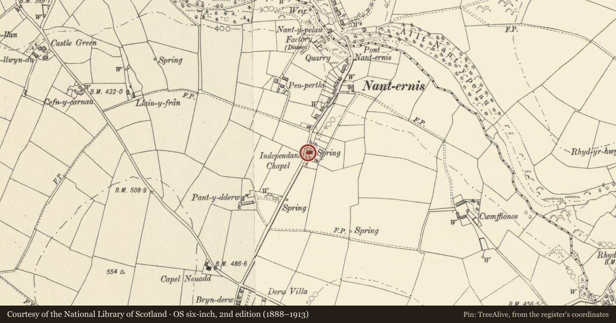
5 historical maps cover this location, the earliest the 1608 map "(13) Cambriae Typus." (David Rumsey Map Collection, Stanford Libraries).
Historical maps covering this location
- 1608 · (13) Cambriae Typus. (David Rumsey Map Collection, Stanford Libraries)
- 1830 · V.3:11-15:XV. Britisches Reich. A. Kon: England. b. Frstenthum Wales: Shire: 37-40 (David Rumsey Map Collection, Stanford Libraries)
- 1899 · 194 Llangranog (Hills) (David Rumsey Map Collection, Stanford Libraries)
- 1901 · Sheet 14. (David Rumsey Map Collection, Stanford Libraries)
- 1919 · Sheet 78. Lampeter. (David Rumsey Map Collection, Stanford Libraries)
Cadw's description
Location
Chapel situated at S end of Nanternis with front walls, gates and rails forming the road boundary and containing large cobbled forecourt.
History
Late C19, probably later than the 1867 Chapel.
Exterior
Low squared rubble walls around three sides of courtyard. Flat stone coping, cast-iron railing above with spear finials, sub-rail with similar finials. Walls recessed in front to central dressed stone piers which have boulder finials above flat coping: decorative cast-iron gate. Cobbles in front of gate incorporating three lozenges of white pebbles.
Cobbled enclosed courtyard.
Reason for designation
Included for group value with Independent Chapel.
Nearby in the register
- Nanternis Independent ChapelReligious, Ritual and Funeraryunder 1 mi
- Pen Craig VillaDomesticunder 1 mi
- NantygraigDomesticunder 1 mi
- RhiwnantDomesticunder 1 mi
Other entries of the same register within about three miles of this one, by straight line.