Cof Cymru: National Historic Assets of Wales · Wales
Church of St. Tysilio
Llandysiliogogo, Ceredigion, Wales
A Grade II listed building in Cae'r-llan, Llandysiliogogo, Ceredigion, designated on 3 June 1964.
The record
- Designation
- Listed building, Grade II
- Broad class
- Religious, Ritual and Funerary
- Date of designation
- 3 June 1964
- Locality
- Cae'r-llan
- Community
- Llandysiliogogo
- Unitary authority
- Ceredigion
- Country
- Wales
- Coordinates
- 52.19128, -4.39571
- Cadw reference
- 9804
Slide toward Today to fade the historical sheet and see the modern map underneath.
David Rumsey Map Collection, Stanford LibrariesDavid Rumsey Map Collection, Stanford LibrariesDavid Rumsey Map Collection, Stanford LibrariesDavid Rumsey Map Collection, Stanford LibrariesDavid Rumsey Map Collection, Stanford Libraries
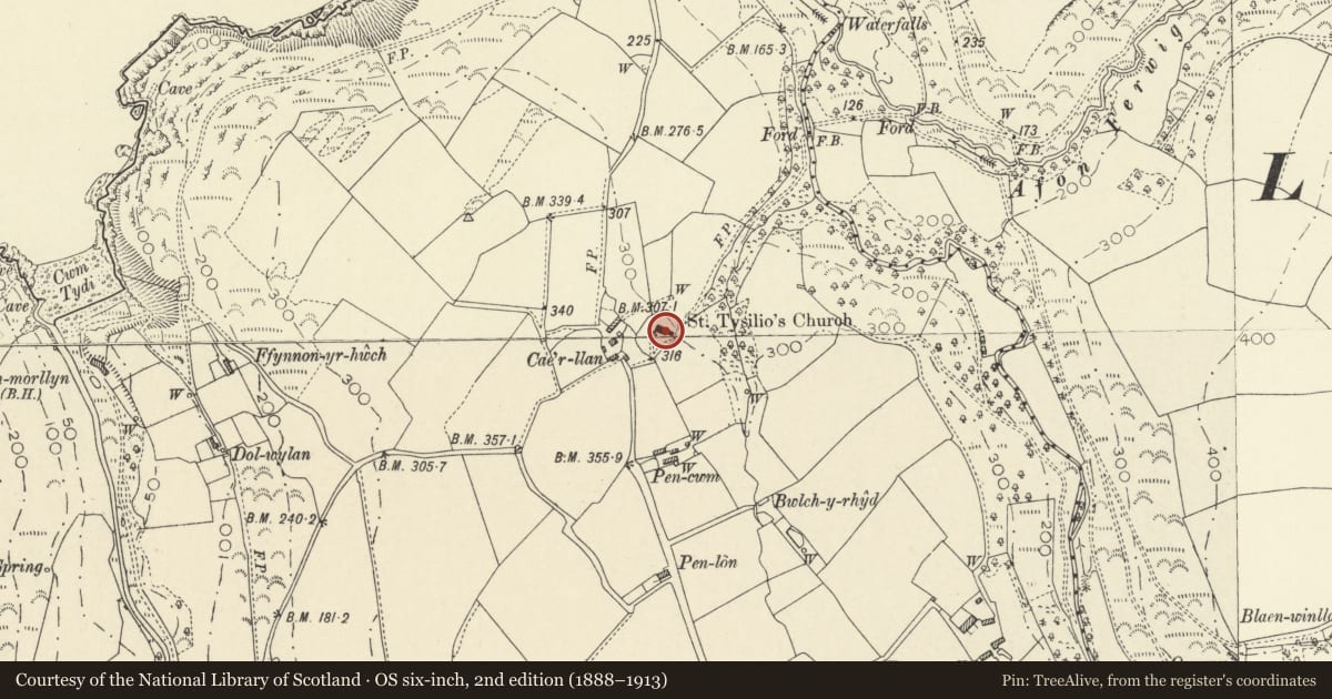
5 historical maps cover this location, the earliest the 1608 map "(13) Cambriae Typus." (David Rumsey Map Collection, Stanford Libraries).
Historical maps covering this location
- 1608 · (13) Cambriae Typus. (David Rumsey Map Collection, Stanford Libraries)
- 1830 · V.3:11-15:XV. Britisches Reich. A. Kon: England. b. Frstenthum Wales: Shire: 37-40 (David Rumsey Map Collection, Stanford Libraries)
- 1899 · 194 Llangranog (Hills) (David Rumsey Map Collection, Stanford Libraries)
- 1901 · Sheet 14. (David Rumsey Map Collection, Stanford Libraries)
- 1919 · Sheet 78. Lampeter. (David Rumsey Map Collection, Stanford Libraries)
Cadw's description
Location
Situated near end of lane, E of Cae'r-llan.
History
Mostly rebuilt 1825-26 (builders, Elias Davies of Llwyndafydd and Henry Parry of Wig), but retains older battered foundations to nave N. Restored and refitted 1890 by D.Davies of Penrhiw-llan, architect. According to S.Meyrick, the pre-1825 church had a S aisle. Circular churchyard denotes early foundation.
Exterior
Nave and lower narrower chancel, tall early C19 gabled W bellcote with 4-centred arch and iron cross-finial. Rubble walls (partly battered to nave N), slate roofs with overhanging eaves. Pointed W door, stone voussoirs, paired boarded doors. Three pointed windows to nave S with simple 1890 Y-tracery: cusping and leaded glazing. Slate sills, stone voussoirs. Two similar windows to nave N. Pointed E window with 3-light 1890 timber tracery, glazing and head as above.
Interior
1890 arch-braced roof of low pitch with king-posts: boarded and ribbed wagon roof to chancel, of similar date. Plain wide chancel arch, extending beyond chancel wall to S. Plain octogonal font, probably pre-C19. Plain late C19 pews. C20 pulpit and chancel fittings. Screened late C19 vestry to NW of nave. Monuments in chancel to Rev. J. Jones (d1887) by D.O.Rees of New Quay and Rev. D.Richards (d1905). Gothic gabled memorial in nave to Evan and Elizabeth Evans, 1882 by Hugh Jones of Caernarfon. Large veined marble tablet to David and Rachel Jones (1875) , signed D.N.; slate surround with quarter-columns within and scrolled top with incised floral decoration.
Reason for designation
Simple, largely early C19 parish church in attractive setting.
A small plain fabric of the local type with few details to enable it to be dated. Medieval with renewed windows. Font with plain octagonal bowl and shaft. Decent modern fittings. Parish Church.
Nearby in the register
- Castell BachHillfortunder 1 mi
- Castle GreenDomesticunder 1 mi
- PenllwynDomesticunder 1 mi
- Former Limekiln at CwmtyduIndustrialunder 1 mi
Other entries of the same register within about three miles of this one, by straight line.