Cof Cymru: National Historic Assets of Wales · Wales
Arcade House
Carmarthen, Carmarthenshire, Wales
A Grade II listed building in Carmarthen, Carmarthenshire, designated on 19 May 1981.
The record
- Designation
- Listed building, Grade II
- Broad class
- Commercial
- Date of designation
- 19 May 1981
- Community
- Carmarthen
- Unitary authority
- Carmarthenshire
- Country
- Wales
- Coordinates
- 51.85636, -4.31226
- Cadw reference
- 9485
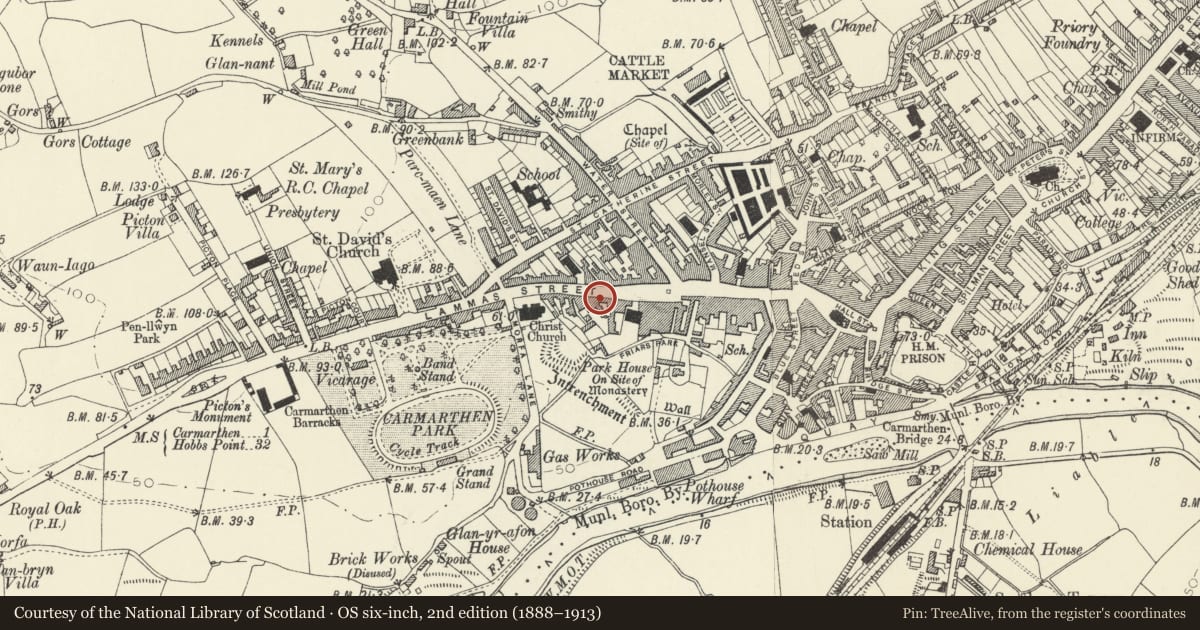
Slide toward Today to fade the historical sheet and see the modern map underneath.
David Rumsey Map Collection, Stanford LibrariesDavid Rumsey Map Collection, Stanford LibrariesDavid Rumsey Map Collection, Stanford LibrariesDavid Rumsey Map Collection, Stanford LibrariesDavid Rumsey Map Collection, Stanford Libraries
5 historical maps cover this location, the earliest the 1636 map "Cornubia : Devonia, Somersetus, Dorcestria, Wiltonia, Glocestria ..." (David Rumsey Map Collection, Stanford Libraries).
Historical maps covering this location
- 1636 · Cornubia : Devonia, Somersetus, Dorcestria, Wiltonia, Glocestria ... (David Rumsey Map Collection, Stanford Libraries)
- 1860 · 41. Caermathen. (David Rumsey Map Collection, Stanford Libraries)
- 1891 · Sheet 10. Ordnance Survey of England and Wales. . (David Rumsey Map Collection, Stanford Libraries)
- 1898 · 229 Carmarthen (Hills) (David Rumsey Map Collection, Stanford Libraries)
- 1901 · Sheet 14. (David Rumsey Map Collection, Stanford Libraries)
Cadw's description
Location
Situated on street line approximately 60m E of junction with Morfa Lane.
History
Terraced house, C19 marked on 1834 map, possibly a public house formerly known at different times as The Old Queen's Arms and The Milford Arms, (but Milford Arms was at No 87 in 1926). Occupied in 1926 by J. Coney shopkeeper.
Exterior
Terraced house, painted stucco, with imitation slate gabled roof and rebuilt red brick stack to right end, taller shaft in front of ridge. Two-storey, 3-window range, offset to left, upper floor with plate glass sash windows. Ground floor with similar though larger window to left of central doorway and to right 4-pane shop window with dentil cornice on carved scrolled brackets. Single step up to door with narrow plain overlight. Plain painted surround with 'Arcade House' in raised letters, painted plinth.
Left end stack of 1981 listing no longer extant, and some detail lost as list describes stuccoed architrave to door. All windows and door renewed.
Interior
Not available for inspection.
Reason for designation
Included as a C19 terraced house, possibly of early C19 origins, later C19 shop window.
Nearby in the register
- No 2 Speedwell CourtDomesticunder 1 mi
- No 1 Speedwell CourtDomesticunder 1 mi
- 97 Lammas StreetDomesticunder 1 mi
- The Golden LionCommercialunder 1 mi
Other entries of the same register within about three miles of this one, by straight line.